2023 has been an odd year. We had a brutal winter, with over 70 inches of rain, and even a rare real snowstorm, dumping almost of foot of snow here. Between that and some construction projects, I logged only 900 miles in the first 6 months of the year. I needed to turn that around, so I got serious on July 1, and by the day of my PMC, I had ridden 950 miles in just over 2 months. I logged good times on two of my timed climbs, putting in my best time in 15 years on each. I was feeling pretty good, and set about selecting a course for my 33rd PMC. I thought about returning to Mt. Hamilton, but it's partially closed for road repairs. Same for Diablo. Instead, I looked for some good local climbs that we haven't used on the PMC before. Three of them are new. This route, shown below, seemed pretty well balanced from a climbing perspective. Dave Gregory, who has joined me for 3 of the last 4 PMC's, would help drag me through the mountains again. I invited 4 other sponsors and previous PMC-west riders to join, but unfortunately they could not make it. Maybe next year!
Schedules finally lined up so we could ride on September 7th, a month after the actual PMC.
|

|
Route map
|
|

|
Elevation profile
|
|
|
Warm-up
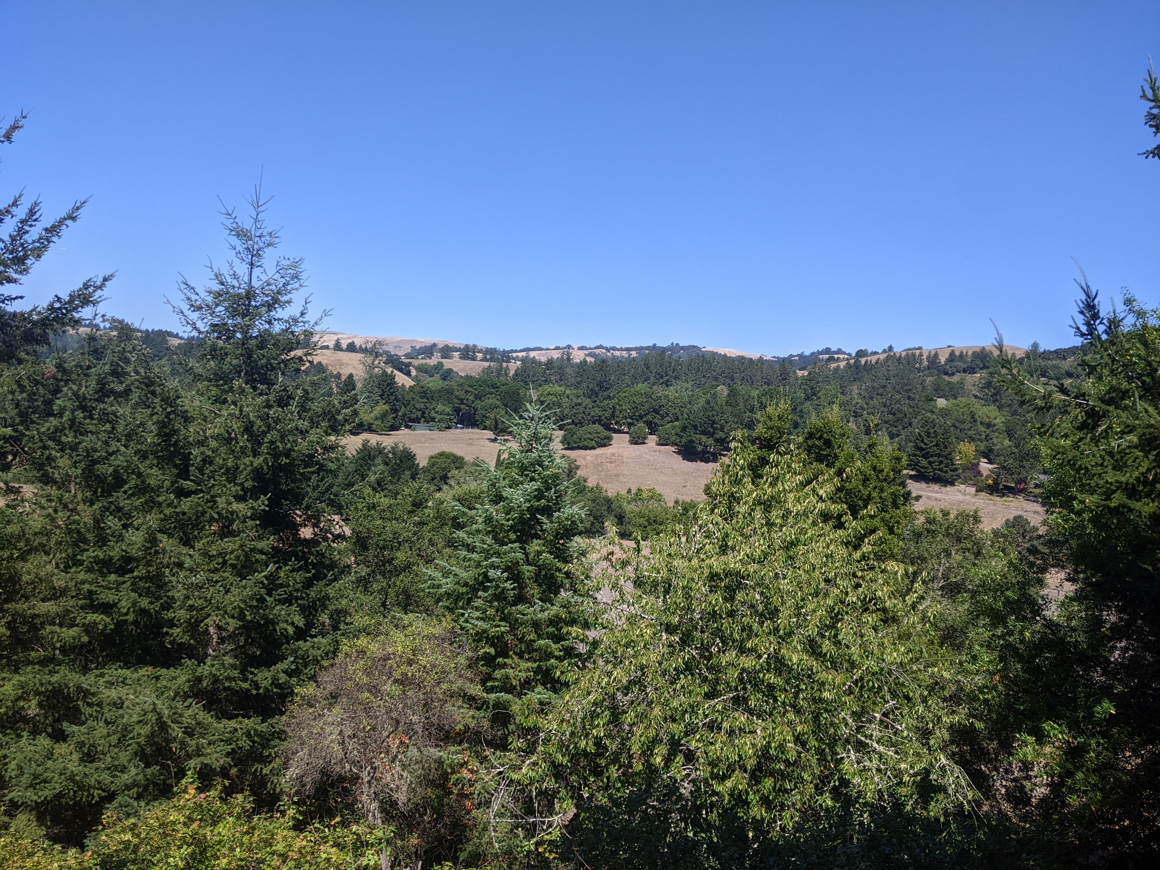
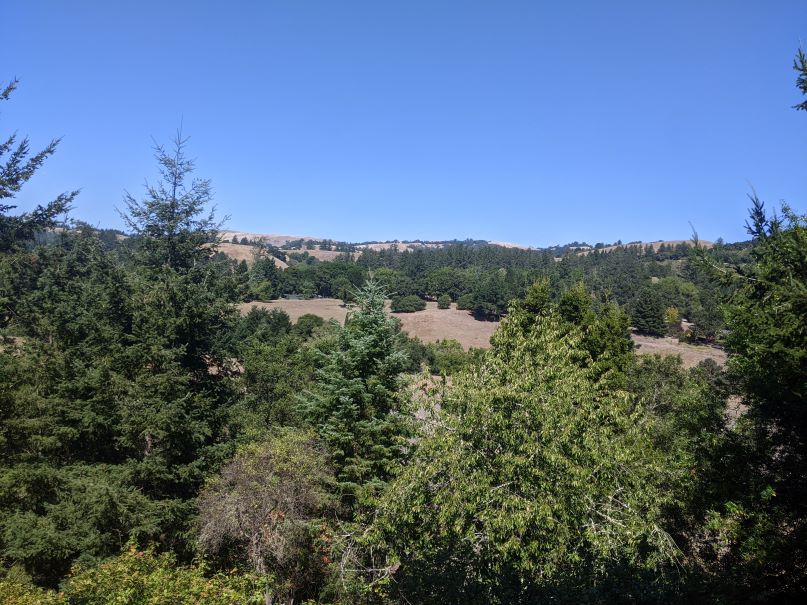
Always looking for a good trip-link, I dropped our Toyota at our mechanic in Sunnyvale for routine service. Before getting underway, I had to redo the front derailleur adjustment I had done just the day before. Satisfied that the shifting was ok, I set out around 9:10. It was cool, in the mid 60s. A few hints of fog were quickly burning off. Other than a few delays for traffic lights and Caltrain, it was a nice warm-up spin over to the Stevens Creek Reservoir. The only issue with riding around the reservoir on a weekday is the quarry, which does a brisk business. The timing was good, though, and I was only passed by about 4 dump trucks. It's amazing that the reservoir is still full - at this time last year, it was just about empty. A little history - Stevens Creek Reservoir is named after Captain Elijah Stephens, who led the first wagon train across the Sierra Nevada in 1844 and settled in Cupertino.
|
The Morning Loop - Montebello
Dave rolled into the reservoir parking lot around 9:45. Montebello Road, all new for the PMC, is right around the corner. I haven't included this climb previously as it's an out-and-back and it was never convenient to end there. This is a steep category 1 climb - 5 miles with 2000 feet of gain. It has sustained sections of 10% with some short sections over 12%. In the elevation profile, the dark reds are over 12%. Right from the start, it's a sharp turn at the quarry from flat to almost 14% in a few hundred feet. It's about 2.3 miles until the one respite - about 3/4 mile of flat to rolling. Here, we can recover before the climbing continues for another 2 miles. It was a solid climb. We did not go all out - still a long day ahead - but we put in a very reasonable time.
At the top there are vineyards all around and sweeping views of Silicon Valley and the east bay mountains (Mt. Diablo is shown here). Dave took this photo of me catching my breath. The gate leads to a gravel road which we could take across to the top of Page Mill Road, but it's 4 miles across, dusty, uneven... We'll stick to the pavement today. Dave also spotted this old bike frame up in the trees. Someone's idea of art? See if you can spot it.
Descending Montebello is very technical and fast, so we took it at a safe pace. We had a short break for a tree crew doing some work - I used the opportunity to grab a quick snack. In the lower part of the descent, we had an exciting moment with some young bucks (deer, not cyclists). I surprised three of them around a bend and they bolted. Two ran across the road, one stayed on the right side. After 100 yards or so, they took off down the hillside. We turned right at the bottom to continue down Stevens Canyon towards Mt. Eden.
Mt. Eden Road is a short, 3/4 mile climb. It has made appearances in my 2012 and
2020 rides. It leads to Pierce Road and a nice counterclockwise loop back through Saratoga, Cupertino, and into Los Altos. Dave had never been through some of these neighborhood roads, parallel to and much quieter than the highly trafficked Saratoga Sunnyvale Road. I don't recall seeing a single vehicle between Pierce and Prospect! This segment has most of the truly flat parts of the ride. Dave offered to set the pace, and I'll never turn down an opportunity to draft. We rolled into Trader Joe's in Los Altos for a lunch break just before noon. Right on schedule.
|

|
Stevens Creek Reservoir
|
|

|
Montebello Profile
|
|
|

|
That was a good climb!
|
|

|
Art?
|
|
|

|
Mt. Diablo in the distance
|
|
|
|
|
Moody and Page Mill Road
It's been 13 years since Page Mill Road appeared in
the 2010
PMC-west (hmmm, I wonder why?). Page Mill has 4 approaches to the climb and for today, we approached by the steepest - Moody Road. Moody is a slow steady climb of about 3-4% for about 2-1/2 miles until a switchback that sends it up to Page Mill at an average 12% for 1/2 mile. It was clearly warming up from our nice cool morning, and we were about to see our hottest temperatures of the day. Once you get to the steep part of Moody, there is no shade until Page Mill. The Garmin tends to overestimate temperature in direct sun, but let's just call it mid 80s. It was hot. We took a short break where Moody intersects Page Mill so I could get the sweat out of my eyes!
Continuing up Page Mill, it's 4.4 miles to the top of the climbing section. It's a different sort of climb. Super steep, followed by a short flat or descent, then super steep again, and so on. Completely exposed, followed by a short stretch of shade. Wow, it was hot. We both commented on how helpful the shady stretches were - it felt 15 degrees cooler in the shade. I said, "Who picked this route, anyway?" with a bit of a smile. We agreed it's not our favorite climb. Some days you can really attack a climb. But for me, this was not that day on Page Mill. I went through 2 water bottles from the lunch stop to the peak, just about 12 miles. Part of one was just dumped over my head. I went pretty slow, needing time to recover. I was resolved just to work hard, not moan about it. A good time to think about why we're doing this ride.
We stopped at a water fountain barely a mile before the peak. More water to cool off. Although the steepest parts were behind us, this section just before the peak is still 9%. Beth was waiting for us at the peak with cold water and banana bread. She got some good action photos below. Even with the rough climb, we were only 15 minutes behind schedule. The road levels off from here and descends a bit to the intersection with Skyline Blvd. After another photo or two, we started on Alpine Road enroute to our last big climb.
|

|
| Peak of Page Mill
|
|

|
| Sweatin' on Page Mill
|
|

|
| Happy to be leaving Page Mill behind
|
|
|
To La Honda and Back
The last big climb of the day is part of a typical training ride.
In order to get to it and make the timing work, we took Alpine Road. This road was last used on my PMC in 2009 but in the other (up) direction. We're not quite done climbing before descending to La Honda. Alpine climbs another 200 feet in the first mile, then it's downhill all the way to La Honda. As it is quite steep, it's not an ideal descent - as with Montebello, lots of care is needed. It's very narrow. Not much room to share with a 28 foot box truck! We stopped briefly to take in the view looking back towards Mindego Hill and Skyline. The bottom half of this 6 mile descent provides a lot of shade, and there are a number of beautiful redwood groves. As we had hoped, it was at least 10 degrees cooler on this side of the summit. At the bottom, Alpine joins Pescadero Creek Road. After a mile, we turned onto Redwood Road, a short climb through a quiet neighborhood. It's also a shortcut to the town La Honda where we started the last climb.
|
|
View from Alpine
|
|
|
|
This last climb is about 6 miles at 5% - nowhere near as steep as the other two climbs. It starts on Highway 84 in La Honda. Highway 84 is a great descent we've done many times on the PMC. On the weekends, it can be a noisy climb with a lot of traffic, but mid-week, it's not bad. And it has a bike lane most of the way. It's about 3-1/2 miles at an average 4% until the turnoff for west Old La Honda. OLH is technically closed due to a slide, but it's easy for bikes to get around, and it's so nice to have zero vehicle traffic! It's a windy one lane road with a nice surface, climbing at a fairly steady moderate grade with a few short steeper bits. Near the top we enter a redwood forest which is a nice bonus. The last 100m of west Old La Honda is a real stinger. Easily 12%. And then we're back to Skyline!
From the top of Old La Honda, it's a short ride north to get back to Highway 84, which we descended back into Woodside. This road was completely closed for months due to a big slide, and only reopened 6 weeks ago with traffic lights in a one lane section around the slide. Approaching the lights, we found ourselves in a long line of cars stuck behind a slower driver, but this worked out well - we were able to descend around 32 mph and not catch up to the cars in front or get passed! We went through Portola Valley and exchanged a parting 'Good Job' as this was Dave's neck of the woods. I still had about 15 miles to go to get back to Sunnyvale by 5PM. I had a few more short climbs to go. The last climb is Elena Road in Los Altos, a little less than a mile at 6%, similar to the earlier climb up Mt. Eden. From there, it's about 10 miles through Los Altos and Mountain view to the finish in Sunnyvale.
This was a good hard ride. It was hotter than expected, but even so, two of the three big climbs went really well. I did about 86 miles - just about 1/3 more than my longest ride this year. For climbing, the ride was just under 8000 feet, also about 1/3 more than in any training ride this year. Dave did about 80 miles with the same climbing (he has a very steep driveway!). I had plenty to eat and drink. Good weather, great company... a fine way to ride my 33rd Pan Mass Challenge.
|
Post Ride
At this writing, I've raised $10300 with the help of my awesome sponsors, on the way towards my $15000 goal. The PMC's goal is $70M. The ride is a challenge, symbolic (though pale in comparison) of the challenge of the battle with cancer. Thankfully, all of my friends who have experienced that challenge recently continue to do well. We all recently lost musician Jimmy Buffett to a rare form of skin cancer; part of his treatment was at Dana Farber. DFCI is an institution I'm proud to support as they are at the forefront of pretty much everything related to cancer, from prevention and early detection to immunotherapy. A good summary of the PMC's impact can be found following that link.
As the PMC says, there's a lot riding on us, and I'm glad to do my part.
|
Thank you so much for your support!
|
|
Return to my PMC home page
|