|
It's been an interesting year so far. Re-reading last year's story, there
are some similarities, but there are also many differences. I called last
year's ride the most difficult PMC-west to date. I guess that would
qualify this year's ride as insane. But let's not get ahead
of ourselves!
So far, fundraising is going well - I'm a little over half way to my goal
of $10000. Long time sponsor and PMC-west veteran riding
buddy Steve joined me for this PMC-west. If
you would like to donate, you can sponsor
me or Steve by following either of those links.
The Year in Review
We've got to go back to the beginning of the year to start the story.
I had every intention of
increasing mileage this year. January started off well, and I was doing 50
mile rides by February. My 1998 Merlin (also known as "the last
bike I'll ever own") had just been collecting dust since
2007 when I got the Look 585 ("The last bike I'll ever own. Really!").
So I sold the Merlin to Steve, who was
training for the Sequoia Century ride (June) and the famous Death Ride in
July. The Merlin was a great fit for him, and the stiffer frame really
improved his climbing efficiency.
Near the end of February, I came down with some sort of flu
which quickly turned into a persistent cough - very tough to ride. I
lost almost a month and had to basically start again. Then, we got pretty
much all of our yearly rainfall from the the end of March until mid-April. So
training started again on May 1.
As we ride together often, it became clear that Steve was becoming
super-fit. Basically, he was riding my Y2K. Around 200 miles a week. I
started thinking about PMC routes. Pretty much anything will be a challenge for me. How can I create one that would challenge Steve? I came up with a few very interesting rides which we'll save for another year. I turned away from the coastal hills and looked towards inland valleys. Something a little different, something a little hotter. Usually.
Then, in early July, in a moment's inattention, I
proceeded to destroy my Look 585, neglecting to remove it from the roof of
the car prior to driving into the garage. D'oh! I test-rode four bikes,
and selected a BMC RM01 with a SRAM Red drivetrain. I really like this bike. It's very stiff laterally and very efficient, while comfortable vertically.
I have been riding faster.
August was the second busiest month my fire company has
ever had. The first weekend (same as the actual PMC) was memorable, with 6 incidents including three wildland fires. I did not ride that weekend.
About then, it was clear I couldn't do a
big PMC ride until the end of August at least. I tried to jam training
into 4 weeks, climbing close to 9000 feet a week, just on the edge of
overtraining. The longest of these rides was about 70 miles.
That brings us to this year's virtual PMC. We did get a lot of pictures this year.
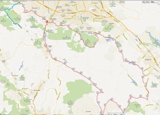
You can click on any picture to see a bigger version. And thanks to Steve's Garmin, we have a great route map and profile. And you can look at the route in great detail (with Steve's start) with Ride with GPS.
|
|
The route. I started on the blue line
at the top left. Steve started offscreen top left.
|
|
|

|
| The route profile.
|
|
|
|
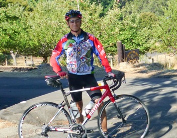
| Chilly start at the fire station
|
|
|
|
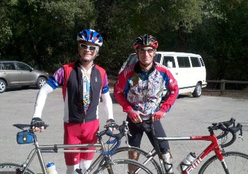
| Second start - base of Mt. Eden.
|
|
|
|
Ride Day
We had a hot start to August this year, but a few days before the ride, the fog came in big time,
up to about 2500'. That made for a very cool start on my PMC day - it was a bone
chilling 48 degrees at
the fire station, where I started.
Steve started from home and we met at the base of the
first real climb. The ride was about two-thirds new territory for
PMC-west, and about 20 miles of it had never been traversed by either of
us. It proved to be a good thing that Steve has a Garmin.
The first sector of the ride climbed Mt. Eden and Pierce Rd in Saratoga, Kennedy Road in Los Gatos,
then Hicks Road. Mt Eden is a short 1 mile climb from Steven's Canyon. It was
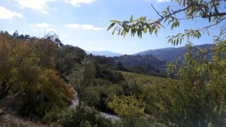
already 58 degrees. We
took this picture of Mt. Umunhum in the distance, as that's in the
vicinity of Hicks. Pierce was also a short steep climb averaging about 8%
for about a mile.
We rode through the town of Saratoga then into Los Gatos. At this point, we could turn right, ride about a mile, and be at the finish. But not today. Today, we're taking the long way around.
After a short break for water, we were on Kennedy Road, which is about a 2 mile shallow climb of about 4.5%. These are all just warm-ups for Hicks Road. Hicks has two sides: hard and harder. I've climbed the hard side before.
Never the harder north side. It's got a two mile lead-in shallow climb
before the 1.5 mile 13.5% average grade main climb. There are several
challenges here. It's completely open - no shade. And unlike Redwood Gulch
and Black Road (both popular training rides) there are no breaks where the
grade flattens out, so no opportunity to recover until the top. Steve was
showing his form, finishing a solid minute ahead of me. Santa Clara County had
been chip-sealing these roads recently, so there was a lot of
loose gravel, making the descent down the back side of Hicks (a mere 9.5%
average) sketchy. We were glad to reach older, more solid surfaces.
|
|
|
View of Mt. Umunhum from Mt. Eden.
Fog is burning off quickly.
|
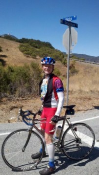
|
| Steve at the crest of Hicks
|
|
|
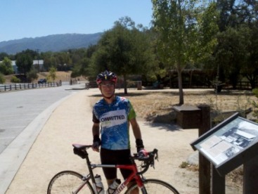
|
Water stop at Chitactac
|
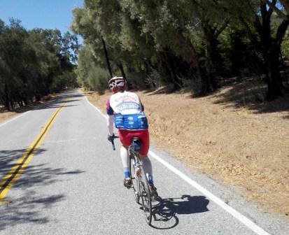
|
| Steve rides on Redwood Retreat
|
|
|
The Reservoirs and Mt Madonna
At the base of Hicks is the Almaden Reservoir. The road continues around the
perimeter of Almaden Quicksilver Park, eventually landing in the Almaden
section of San Jose. We turned onto McKean road for the flattest sector of
the ride - rollers which go out around two more reservoirs - Calero and
Chesbro. In this section, I led quite a bit of the time, trying to keep
the pace up into a headwind. It was quite breezy, but temperatures were climbing into the low 80s. In this area of Morgan Hill, we rode through a
variety of vineyards, farms, and ranches. There's a short 1 mile
climb just before Watsonville Road. This was where we get into unfamiliar
territory. We enjoyed the nice smooth surface and slight
downgrade to our second water stop at Chitactac-Adams County Park. From
here, there are two ways up and over into Santa Cruz County - Highway 152 / Hecker Pass (the boring way with lots of traffic) or Redwood Retreat road and Mt.
Madonna road (the interesting way with no traffic). Of course we went the
interesting way. And how interesting it was.
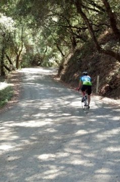
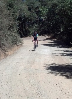
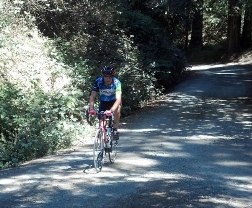
Redwood Retreat Road is a quiet road which climbs gently towards Mt. Madonna. At the intersection between Redwood and Mt. Madonna Road, we consulted the Garmin to make sure we were supposed to turn on Mt. Madonna. Confirmed, we made the turn. Mt. Madonna is 2.5 miles long, and starts a serious climb immediately. It's shady, but it averages 9.3% with some segments over 12%. That is a good challenge, but the real challenge starts just over a mile in. The road becomes unpaved. That's right. Dirt and gravel. We knew this ahead of time, but we really didn't know exactly what to expect. You really want to climb out of the saddle on a 10% grade, but you can't on dirt, because there's no traction. So it becomes a balancing act - too far forward, lose traction. Too far back, pop a wheely. And you have to avoid the occasional sand pit. I hit one, totally lost traction, and had a put a foot down to avoid falling over. It's tough enough re-starting a 12% climb on pavement; it's really tricky on dirt. As I was ahead at this point, I made sure Steve stayed on the other side of the road which was more solid. "This is CRAZY!", I shouted.
We continued battling the gravel, rocks, and roots on up the road. We only ran into one car headed down hill. The driver was kind enough to stop and let us by.
We took a short break at the top to consult the Garmin and the road signs to find the Santa Cruz County side of Mt. Madonna. It turns out Mt. Madonna is very similar in shape to Old La Honda Road in Woodside, a perennial favorite climb. The back side is paved, one-lane, steep, and transitions from redwood forest to an open area over a few miles. It's a zippy descent, but as neither of us had done it before, we approached it with caution. The first stop sign is Hazel Dell Road, where we turned right. Below are several images from the Mt. Madonna climb.
|
|
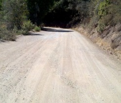
|
Dirt Mt. Madonna. Starts out smooth.
Whose idea was this?
|
|
|
|
Andy leads out Mt. Madonna. It's a real
balancing act. About a mile to go.
|
|
|
|
After getting un-stuck from the sand.
Tough to see how steep this really is.
|
|
|
|
Whew, finally at the crest.
That was CRAZY!
And a lot of work.
|
|
|
|
Corralitos and Eureka Canyon
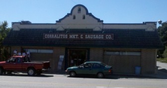
Hazel Dell Road presented one more climb before our lunch break. After climbs like Hicks and Mt. Madonna, Hazel Dell was a pleasant 6%, shaded, and only about 1.5 miles before a smooth descent along Browns Valley into Corralitos. The sausage shop in Corralitos is a great place for lunch. We split a sandwich, fixed a flat, and were on our way.
We started up the last climbs of Eureka Canyon and Highland. Having already done 72 miles - longest ride of the year for me already - my legs were getting pretty tired. Eureka was on the first PMC-west, and I've climbed it once already this year. It's not steep, but it is long. Over 16 miles, there's a 7 mile climb of about 5%, then a descent, then another mile of climb, then it's pretty much downhill to the finish. Just outside Corralitos, we passed an apple orchard with trees ready for picking - guess I've never been in the area in this season as I've never noticed them before. Once into the climb, it climbs through the forest. On a few occasions, I fell back, finding it tougher to keep pace. After a Gu and a little recovery, I managed to catch up. We're basically in the San Andreas Rift zone in this area, and maybe 5 miles from the epicenter of the Loma Prieta earthquake. It's a strange area. The road kicks up here, and as I got out of the saddle - I realized, "Nope, I haven't got it". I grunted and groaned a bit
through the last few miles of climbing.
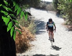
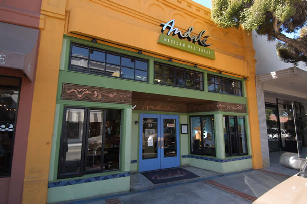
Once on Summit road, we had only about 11 miles to go. There were a few little bumps to get over on Summit, then there's the descent of Old Santa Cruz Highway, which we really enjoyed. It's about 4 miles, very nice pavement, and not super steep. This bottoms out at the Lexington Reservoir. After a short quarter-mile stint on Highway 17, we exited to tackle the last challenge of the day. The trail from the reservoir to Los Gatos is dirt (more dirt!), and has one short but incredibly steep downhill. It's a good exercise in bike handling. Luckily, there was no one coming up, and we both made it through. The end of the trail was mostly flat until the steep exit to Main Street, shown below. From here, it's a stones throw to Andale, where we had dinner with Beth and Steve's family, wife Jane & daughter Lauren.
I rode just over 100 miles, climbed around 9000', and finished in just under 7 hours - I was quite happy with that! Steve did 96 miles, 8500'. For me this was almost half again as long as my longest ride this year. It was a very tough, interesting, enjoyable, and rewarding ride. Steve is King of the Mountains, first over 7 of 8 climbs. I was glad to have such good company, and it was fun to see two bikes I have owned in the same event at the same time.
|
|
|
Corralitos Sausage Shop
|
|
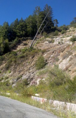
| Big slide on Eureka Canyon
|
|
|
|
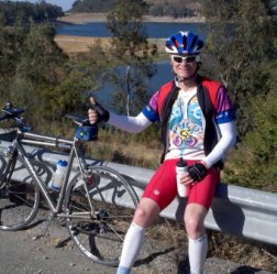
Steve at Lexington Reservoir
|
|
|
|
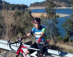
| Andy at Lexington Reservoir
|
|
|
|
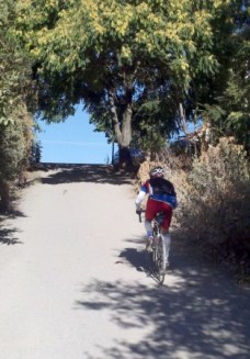
Steve powers his way up
the last climb of the day
|
|
|
|
Exiting the Los Gatos creek trail.
I am so in the wrong gear....
|
|
|
|
Andale Taqueria in Los Gatos
|
|
|
|
The Year in Review, Part 2
Like most years, family, friends, and colleagues have been touched in some way by cancer. This year, Beth lost a work colleague to pancreatic cancer. We have several friends in remission, and unfortunately one in recurrence. I know that the research conducted at the Dana Farber Cancer Institute continues to discover new ways to arrest cancerous growth, and clinical trials conducted there lead to effective treatments of many forms of cancer. In the final analysis, I'm just a conduit to help get them the funding they need to continue to make progress. The PMC has an old saying: Closer by the mile. It's true.
As always, thank you for your support and encouragement!
|