You knew that was going to be the title...
Last year, I said that this year, I'd be saying that I can't believe
it's my 20th Pan Mass Challenge. Well, it's true. I
can't believe it. In 1991, my friend Chris convinced me
to replace my aging Fuji Sports-10 with a real
racing bike (a Cannondale R600, 12 speed, with downtube
shifters), and shortly thereafter,
convinced me to join him at the PMC.
Since then, three more bikes have come and gone, and my
latest, the Look 585, has 20 gears and integrated brakes/shifters.
20 gears for 20 years.
Once again, I rode a virtual PMC here in California.
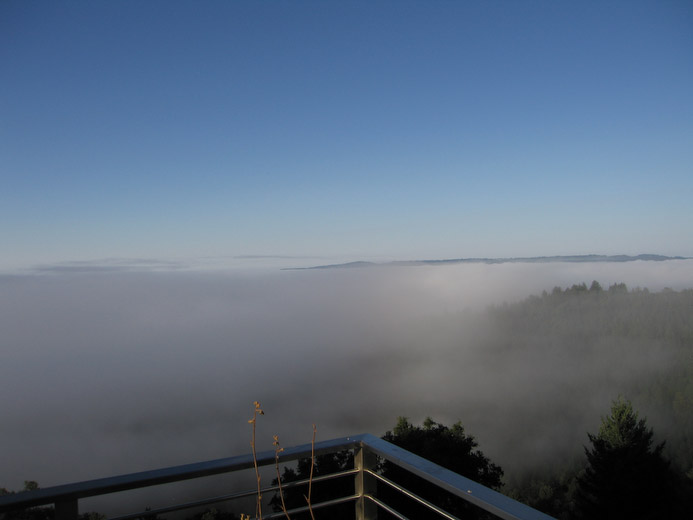
The weather has been unseasonably cool in the bay area this year. Ride
day dawned with the canyons below our house full of
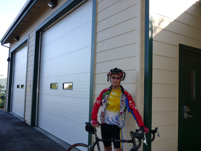
fog. I started the ride around
8:15 at the fire station and descended into Santa Clara
County via highway 9, just like last year, but this year
I descended into the fog. Chilly! On the mountain
crest, where I started, it was sunny and in the 60's.
By the bottom of the hill, in Steven's Canyon, it was
about 48 degrees and I was glad to have a jacket.
Brrrrrr. As I rode I was thinking about the route
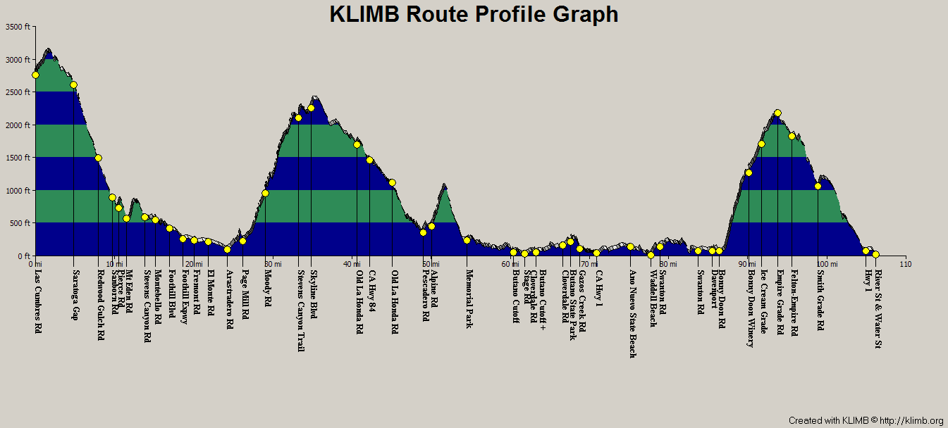
ahead. Two major climbs; one
lesser. Route and profile are below. Note that images
can be enlarged by clicking on the image.
|
|
Fog in the San Lorenzo Valley. A
tiny sliver of
Empire Grade is visible above the fog. We will be there later.
|
|
|
|
| Starting at the fire station, as usual
|
|
|

|
The route. Starts at the center.
|
|
|
|
| The route profile, from Klimb
|
|
|
|
First Climb
Long time sponsor and virtual-PMC veteran Steve had signed up to ride with
me. But this year, Steve registered as a virtual PMC rider
himself! Great! Expanding the franchise!  Like last year, we met in Cupertino,
this time at Peet's for an espresso and a lemon
scone. We started up Foothill expressway under partly
cloudy skies, with temperatures around
60 degrees. In past virtual PMC's we have climbed up to
Skyline via Old La Honda, Highway 9, and Kings
Mountain. There was only one climb left which we
hadn't done before on a PMC: Page Mill, the most
difficult way up the hill. It's about 2000' over 7.5 miles, but it
gives up the elevation a few times, and in between there are some
very steep sections of 12% gradient. This is not Steve's favorite climb, but as it was cool, maybe ...
We took it at a reasonable pace, and Steve did fine. There's a water fountain
about 2 miles from the top, so we topped off there.
Our plan was to join the Tour Of California Stage 3 route at Sky Londa, so we turned north on Skyline. We ran into the fog; jackets again. At Highway 84, I'd done 42 miles. The next 61 would follow the TOC route.
|
|
|
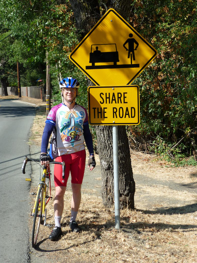
| A sage sign. Steve at the base of Page Mill
|
|
|
|
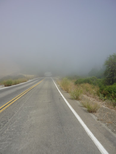
Entering a tunnel of fog on
Skyline. Those are
large fir trees
ahead which you can barely see.
|
|
|
|
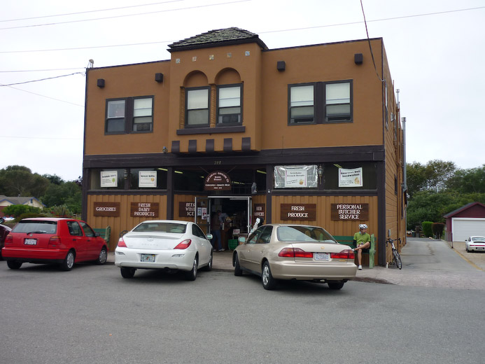
| Lunch at Arcangeli, encore
|
|
|
|
The Coasters
The next segment has appeared on several v-PMC's, including last
year's. We descended to La Honda. The fog had
disappeared, so... yup, off with the jackets. We
climbed Haskin's Hill - a short 2 mile climb at a
fairly constant 7% - then decended to Pescadero for lunch at the Arcangeli bakery. Anyone visiting the area should make
Pescadero a stop. A fresh warm garlic/herb bread from Arcangeli; a
bowl of artichoke soup at Duartes; or a stroll through Made In Pescadero
are all fun things to do. We dawdled a bit here, which made the restart
very tough. This year, rather than going north, we turned south on
Cloverdale/Gazos Creek. Normally,
this direction has a tailwind, but apparently, no matter what
direction I go from Pescadero, it's always a headwind. Slow going.
As well, this road has some construction and has sections of loose
gravel. In the worst locations, for example,
around blind corners! We both stayed upright, but there were some wiggly moments.
We turned onto Highway 1 at a point 14 miles north of Davenport. This
stretch of the Pacific Coast Highway is
anything but flat. Up, down, repeat. We were glad to pick up a tailwind for a
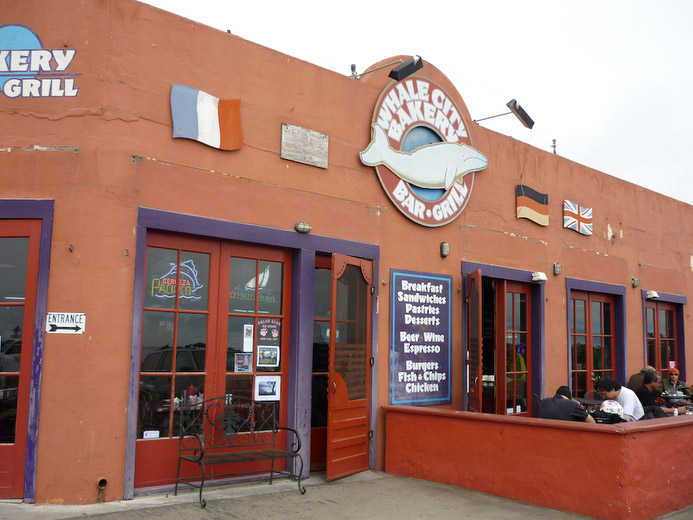
short stint near Ano Nuevo. We arrived in Davenport and found the
Whale City Bakery, shown here, which makes the best
oatmeal raisin cookies. Another must-see if you are
visiting here. We topped off the water bottles then
continued south on 1. It was only about a mile until the left turn for the last big climb...
The Doon
Bonny Doon road is another 2000' climb to a ridge.
Like Page Mill, it's flat for the first 1/2 mile, but then it turns
up sharply to about 11%. It alternates between 1/2 mile of 10-12% and 100 yds of 6-7%
for 3 miles. There's even one short section of one tenth of mile at
close to 20%. Unlike Page Mill, you don't give up the
climb - there are no downhills. This is a tough climb
after 82 miles! Rather than go all out I just found a
good groove and stuck with it, periodically doubling
back in the flatter sections to pick up Steve who was
by now, in his own words, in "tortoise mode". That's
when you just put your head down and crawl.  Like Alpine Road was for me last year.
Back in May, Beth and I were near the midpoint of
Bonny Doon watching the pros climb at the
Amgen Tour of California
(a few pictures if you follow that link).
Today, Steve would say "Mostly, we followed the
TOC stage 3 route, and I can appreciate what the
pros do in a few hours; took me the whole day!"
How true. He was
quite happy when Bonny Doon Road became Pine
Flat Road. It's only flat for about 1/4 mile,
but when it starts climbing again, it averages about
5% -- certainly nowhere near as steep as the
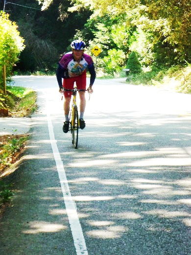
bottom. Here's Steve cresting
after a tough climb.
|
|
|
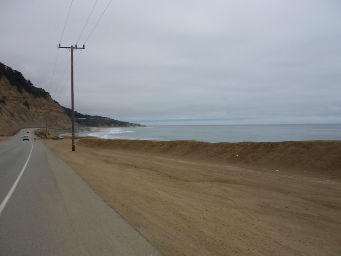
Along highway 1 north of
Davenport.
The spec in the distance next
to the car is Steve.
|
|
|
|
| Whale City Bakery, Davenport
|
|
|
|
| Steve crests Bonny Doon
|
|
|
Cruzin
The last segment of the ride was the descent of Empire Grade Road into Santa Cruz.
This has a few very steep downhill sections (12-14%) and a few short climbs on the way
down. About 2 miles in, Steve got a hamstring/quad cramp; a short break, some water
and a Gu later, we continued on, getting into downtown Santa Cruz.
For me, it had been 103.5 miles and some 7700' of
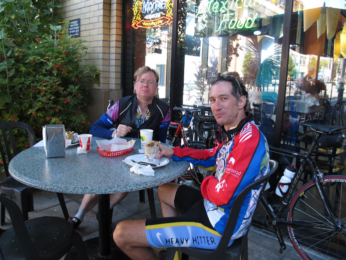
climbing; about 7.25 hours of riding. We had a late lunch at Taqueria Vallarta, shown here stuffing our faces. Beth
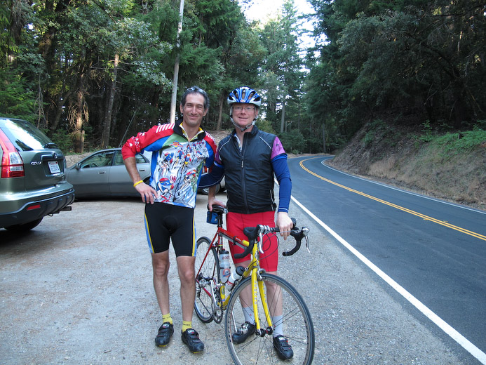
picked us up for the trip back to the summit. Steve was determined
to finish the ride, so we dropped him at Castle Rock to
complete the route. He followed the same path I did in the AM, and
did the same mileage. What's really impressive is that
this is more than twice as long as his previous
longest ride this year! He put in a stellar effort.
|
|
Late lunch at Taqueria
Vallarta
|
|
|
|
Andy and Steve at Castle
Rock
Another one in the books. Almost.
|
|
|
|
Twenty
It was a great ride. After last year's ride, I was
determined to be more fit this year, and I was. I had a
training plan and stuck to it. The weather was cooperative too; it's a lot easier to
do 7 miles of climbing when it's 60 degrees rather than
pushing 90. I was very grateful for Steve's company along the route.
We've gone a whole year without a new cancer case across
friends and family, and I'm very thankful for
that. Over the past 20 years, the funds generated by the PMC
have been used to great purpose at Dana Farber. The result,
in part, is seen in increasing survival rates of pediatric
cancers and breast cancer; decreasing incidence rates of
colon cancer and lung cancer; and overall declining rates in
cancer deaths. It's fitting that the ride was on my Dad's
birthday as he is a cancer survivor, as is my mom.
This is why I ride.
Thanks for your support!
|

 Like Alpine Road was for me last year.
Back in May, Beth and I were near the midpoint of
Bonny Doon watching the pros climb at the
Amgen Tour of California
(a few pictures if you follow that link).
Today, Steve would say "Mostly, we followed the
TOC stage 3 route, and I can appreciate what the
pros do in a few hours; took me the whole day!"
How true. He was
quite happy when Bonny Doon Road became Pine
Flat Road. It's only flat for about 1/4 mile,
but when it starts climbing again, it averages about
5% -- certainly nowhere near as steep as the
bottom. Here's Steve cresting
after a tough climb.


