Just before Christmas 2020, my mom lost her 5 year battle with lung cancer. She was about 6 weeks short of her 91st birthday. Earlier in her life, she had survived breast cancer in 1981. In the intervening 39 years, she got to see graduations and weddings and grandchildren. She was one of the main motivators that got me started with the PMC in 1991. All of my PMC rides have been in part for Mom; this one is all Mom. So from the beginning of the year, I was planning a very tough PMC ride. I drew up a list of a dozen different rides - some up to 112 miles and 12000 feet of elevation gain. For 15 years, after these PMC-west rides, I would share the story with Mom. She would listen intently, then invariably ask: "Why do you have to make the ride so hard?"  So, perhaps in deference to her wishes, I threw out the three most difficult rides on the list. So, perhaps in deference to her wishes, I threw out the three most difficult rides on the list. 
|
|
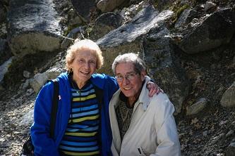
| With Dad at Yosemite, 2006
|
|
|
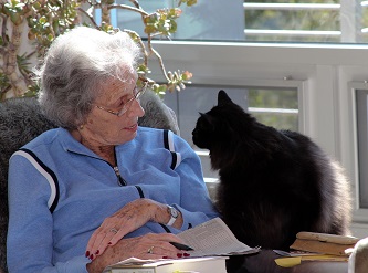
| With Cole in 2013 - Kindred spirits
|
|
|
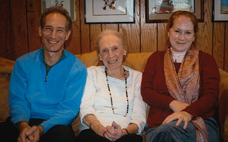
| With me and Beth at her 90th birthday, 2020
|
|
|
|
Pre-ride
I was able to get in a reasonable amount of training - thankfully, it helped that most of California's fires have been elsewhere this year. After getting into something of a rut mid-winter, I tried to break out of my standard rides, looking for more variety. Some rides down on the coast, some up in San Mateo county, some down around Corralitos. Things started coming together in July after I changed my on-the-bike nutrition plan (thanks Kyle!). More recently, air quality from the fires up north has been making it a little more difficult to get out some days, but with a projected 2000 miles of training this season, it seemed like I'd be peaking by the end of August.
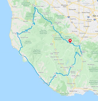
Steve Meier was unable to join this year, but Dave Gregory (who joined me for the 2019 ride) planned to share about 20 miles of his Tuesday ride with me. I did a few training rides with Dave this year. He is a very strong rider, especially when it comes to climbing. Some of our rides centered around Old La Honda Road, a classic SF Bay Area climb. Training with Dave, I cut 10% off of my time on this 3.5 mile, 7.5% climb. Maybe another 10% next year? In 2020, my ride was 80 miles, flatter, with one long climb. This year, I planned a smidge over 100 miles, and about 9000 feet of elevation gain with 5 climbs greater than 2 miles. The last 35 miles is a trio of climbs from the coast back to Skyline: Bonny Doon Rd, East Zayante Rd, and Black Rd, each climb with difficult sections 12% and higher. Let's see how that worked out... 
|
|
Route map
|
|

|
Planned profile - end looks tough
|
|
|
Woodside, Pescadero and the Coast
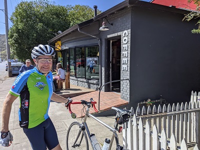
We had planned to ride Saturday the 28th, but the air quality was poor - not nearly as bad as last year, but still unacceptable. It didn't start to clear out until Monday afternoon. Tuesday morning was clear and a mild 75 degrees on the mountain, while foggy and 55 on the coast. I began at 8:15 at the familiar start line (my fire station) then traveled Skyline Blvd north towards Woodside, just like last year. I kept a reasonable pace, knowing I had a long way to go. There are two short (2-mile) climbs along the way - a good warmup. I met Dave at the top of Old La Honda and we made the left on Highway 84 towards the coast. It's a zippy 7 miles to the town of La Honda where we turned left to the first real climb: Haskins Hill. This has made many appearances on PMC-west. It's about 1.8 miles at 6% through a redwood forest. Always a favorite. The descent and the flatter roads through Sam McDonald County Park and the town of Loma Mar are shaded by tall redwoods. We pulled into Pescadero around 10:30 for a snack at the local coffee shop. Pescadero is a great place to visit. In fact, it's one of the places we took my Mom & Dad when we first moved here.
|
|
Coffee at Pescadero
|
|
|
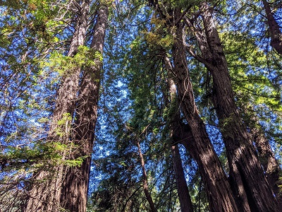
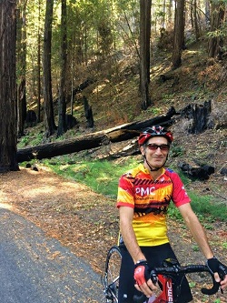
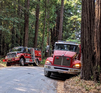
Here, I expected Dave to turn north and do the rest of his ride, but he surprised me by offering to do a significant part of my whole ride! The PMC is better with friends. And Dave keeps me from getting lazy on the bike... We resumed the ride turning south on Cloverdale Road, which I last rode in the 2010 PMC. We took a short detour on Canyon Road for a few reasons. It's a very pretty road with old-growth redwoods, some 14 feet wide at the base. It's a very spiritual place. And... I was here, one year ago today, almost to the hour, working on the CZU fire. Today, and last year, shown here.
|
|
| Canyon Road's old-growth redwoods
|
|
|
| Canyon Road today
|
|
|
| One year ago, same place, same time
|
|
|
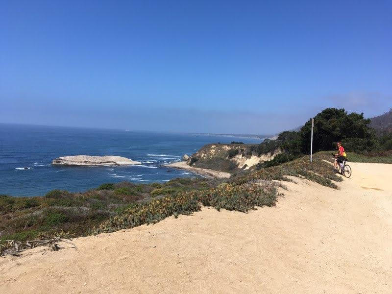
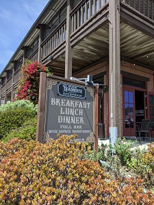
Cloverdale Road is mostly flat with a few bumps. It intersects with newly-paved Highway 1 where we turned south towards Davenport. Normally, we'd have a pretty nice tailwind, but today was more of an on-shore crosswind. Dave led most of the way thru this segment. At times, I had a hard time keeping his wheel, but we found a solid pace that worked. We stopped for one scenery break - Mom always loved a beach. Along the way, we passed Wadell Creek and the Big Creek lumber yard, two more of my haunts from the CZU fire. We pulled into Davenport for a leisurely lunch at The Roadhouse. I'd already done 64 miles, but most of the work was still ahead. Recall the plan: 3 climbs, each about 2000 feet of elevation gain, with the most difficult saved for last. I've done each of these climbs before, but never in combination. This should be interesting.
Let's Climb!
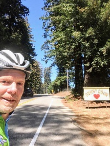
The first climb from the coast is Bonny Doon Road. This made an appearance in my 2010 PMC ride. I don't think I've climbed it since, though I did spend quite a lot of time around here a year ago during the CZU fire. This year, we're doing a slight variation on the climb, going right at the Y in the center of Bonny Doon, along Martin Road and Ice Cream Grade (which Steve and I descended in 2011). It's a tough climb. It averages 5% over 5.5 miles, but the beginning is very tough with a long stretch at 10%, with short stretches at up to 13%. It's a bit tougher after a long lunch break! The legs took a while to warm back up. Dave goes very well on climbs like this. I struggled a bit, but my new big cog came in quite handy for recovery. I definitely climbed this faster than I would have alone. A good sweat. Ice Cream Grade shows a lot of fire damage, but the fire stayed mostly on the ground here, so it's also shaded. Even though it was only 75 degrees or so, it's still better in the shade.
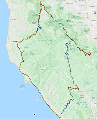
At the top of the climb we reached Empire Grade. At this point, it was already my longest ride of the year at 72 miles. The plan was to descend Felton-Empire Road, a steep technical descent, which we climbed on my very first remote-PMC in 2005. But what's this? Felton-Empire is closed for construction? DOH! Still remnants of the CZU fire. Culverts and guardrail reconstruction. Time for a reroute. There are only two choices: down to Santa Cruz, or up Empire Grade towards Ben Lomond. For Santa Cruz, a quick back of the napkin calculation looked like quite a bit of time added to the ride. North on Empire Grade with the Highway 9 route up to Skyline made the most sense. So... below is the actual map, and the actual ride profile, recorded by my Garmin. The map is color coded. Blue is slow, red is fast. Just in case you were wondering...
|
|
Pacific Coast near Swanton
|
|
Lunch at the Davenport Roadhouse
|
|
|

|
| Bonny Doon elevation - lots of purple at the start
|
|
|
Dave on Bonny Doon Rd, just before
Martin Rd. The sign is bits of tile!
|
|
|
|
Revised Route map
|
|

|
Elevation profile - end still looks pretty tough!
|
|
|
Detour
Empire Grade climbs immediately and continues up for about 3.5 miles and a 700 foot elevation gain. There is significant fire damage all through this area. Shortly after the peak we turned right on Alba Road which dives down from the peak of Empire Grade to the town of Ben Lomond. Now, no one really wants to descend Alba. It is the most difficult climb in Santa Cruz County with an average grade of 10% and quite a bit over 15%. Very steep. Some roads are just too steep to be an enjoyable descent. We took it gingerly and made the 4 miles and -2000 feet safely. Turning left on Highway 9, we hit our first traffic of the day. I've done this stretch of road many times this year. I assured Dave that once we got thru the next town (Boulder Creek), the traffic would drop off quickly. One way to get out of the traffic faster is to ride faster. As it's mostly flat for 10 miles after Ben Lomond, we picked up the pace. Even after 80 miles, I was able to keep up with Dave. In the flats, anyway. That nutrition plan seems to be working. We pulled into a grocery store in Boulder Creek for a quick fig bar before the last big climb.
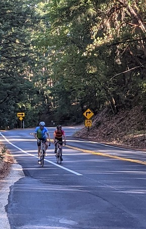
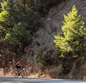
The beginning of the climb starts 8 miles before Skyline. The first two miles average about 7%, and it's mostly exposed. I was slowing down a bit but still feeling pretty good. Beth met us at the 2 mile point so we could fill up on water and get a quick snack for rest of the climb. Highway 9 goes up in steps, with short flat sections connecting them. Mid way, Beth had pulled over to get some pictures. Below, there's a picture and short video with Dave basically sitting up to let me get ahead.  All good fun. Amazing that after 94 miles, I still had some energy for a short sprint. Shortly after this, we decided Dave should go ahead - he had more miles to go to get home, and he can climb a lot faster than me. I thanked him for his company and for towing me around the mountains, and off he went. I got to the top of the climb about 6 minutes after he did (see below). All good fun. Amazing that after 94 miles, I still had some energy for a short sprint. Shortly after this, we decided Dave should go ahead - he had more miles to go to get home, and he can climb a lot faster than me. I thanked him for his company and for towing me around the mountains, and off he went. I got to the top of the climb about 6 minutes after he did (see below).
|
|
| Smile for the camera!
|
|
Short Video from Highway 9
Note: access to Google Drive required. Try this link if the
embedded video doesn't work
|
|
|
| Top of Hwy 9 - only 6 miles and 500' to go...
|
|
|
The climbing does not end at Skyline (about 2650'). It ends after Castle Rock State park (about 3100'), so with the little descents in between short climbs, there's 500' to go. I decided to end where I had planned - at the top of Black Road - for 3 reasons. It was the original finish line, it has a really nice descent to it, and it would give me the longest ride I've done since 2005. My ride was 103.75 miles with almost 8800' of gain - the most climbing since the 2014 PMC in Yosemite. Dave did 103.5 miles, and almost 9300' of gain (!). It was a long, hard day, with great weather and great company - just what I wanted. A few surprises (a re-route, and ... company) but what's life without a few surprises? It was great to have Dave on the ride, for the company of course, but also to set the riding tempo. I was sore after the ride - mostly my arms and shoulders, but... good! It means I worked hard. I did have to delete the Black Road climb, so let's say I owe the sponsors one. Maybe next week.
Miles for Mom
How did we get here? I started doing the PMC 31 years ago to honor both of my parents' successful battles with cancer. Since then, I've noted a dozen family and friends, some whose battle with cancer continues, some who could not overcome it. Though currently overshadowed by other pressing medical issues like Covid, cancer research continues non-stop at places like Dana Farber. Over the decades, this research has brought amazing breakthroughs in treatment. I'd like to think that some of these breakthroughs contributed to the 30-some years that my mom was cancer-free, and the 4+ extra years she had living with lung cancer. And we get that research through funding from events like the PMC. The PMC is well on its way to hitting this year's goal of $56M. At this writing, I've raised $18000 with the help of my awesome sponsors. I also know there is at least $2500 in corporate matching funds in the pipeline, so thanks to you all for helping me exceed my $20,000 goal, and for helping me up my game: in fundraising, in elevation gain, and in Miles For Mom.
|
Thank you so much for your support!
|
|
Return to my PMC home page
|
 So, perhaps in deference to her wishes, I threw out the three most difficult rides on the list.

 All good fun. Amazing that after 94 miles, I still had some energy for a short sprint. Shortly after this, we decided Dave should go ahead - he had more miles to go to get home, and he can climb a lot faster than me. I thanked him for his company and for towing me around the mountains, and off he went. I got to the top of the climb about 6 minutes after he did (see below).


