|
2019 was another challenging year for riding. Let's recap. Last year, just as I was reaching peak form and maybe a month before my PMC ride, I spent a week at the Ranch fire in Lake County, and when I returned, an accident at the fire station left me with a broken elbow. Although the bones healed nicely, weeks of immobilization put me on a course to a frozen shoulder, and an unsatisfactory range of motion in my elbow. Shoulder physical therapy finally started in January, and today, my PT says I'm 65% of the way towards full range. After 10 months of PT total, I have regained a lot of strength in my right arm. But what about my elbow? Well, it's just stuck at around half of acceptable range of motion. So a second surgery is needed, and the timing is an unknown. So we're riding early - the actual PMC isn't for 2 1/2 weeks. I try to keep things in perspective. This elbow event is certainly an inconvenience and an annoyance. But it's not cancer.
I only started riding at the end of April, and logged just about 500 miles prior to the ride. This is about 1000 miles short of a typical year. My longest ride was about 46 miles, and I think the longest continuous climb was 2 miles and 500 feet. So I needed to choose a ride which was a challenge, but not as many miles, and not as much climbing as usual. Long time riding partner Steve would join me, as well as a new face: long time friend and sponsor David. We've been trying to get David on this ride since 2014, and we've finally done it. David is an avid cyclist, and recently returned from a trip to Italy where he rode about 500 miles. He's quite fit.
There's much motivation for the ride. It's been an up and down year with our connection to cancer. My mom is still keeping lung cancer at bay. My cousin Ken, diagnosed with cancer early this year, is in remission! Our dear friend Liz is doing very well after her battle with cancer earlier this year. Steve's cousin Momoko is still locked in a multi-year battle, but doing well enough to be at home.
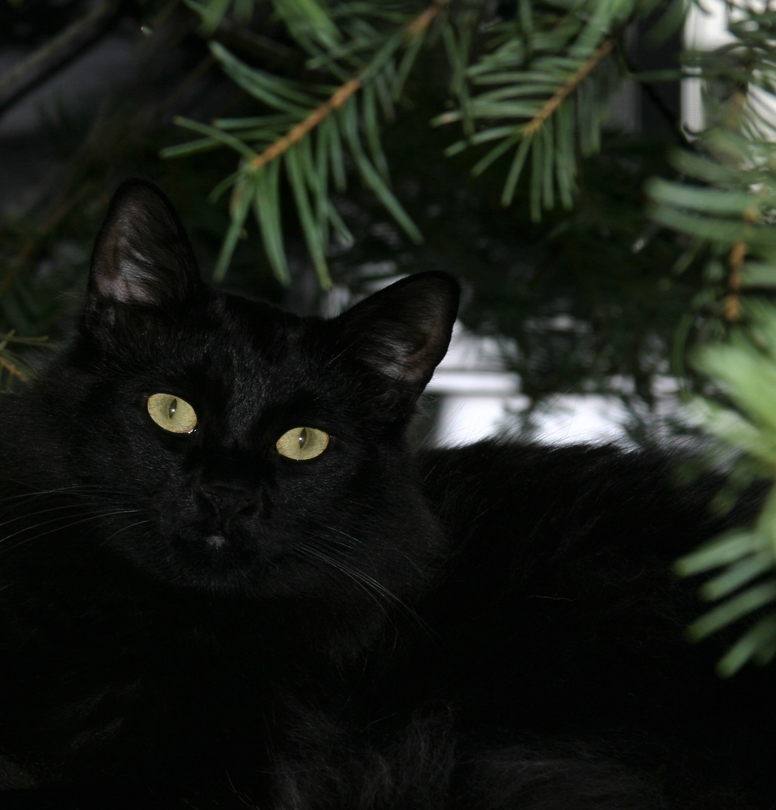
With all of these positives, sadly, we lost our cat Cole to cancer early this year. Cancer affects pets, too. He was not quite 11 years old. He was a sweet guy, with a lilting voice and a great purr. We miss him.
As usual, most pictures can be enlarged by clicking on them.
|

|
| Route Map
|
|

|
| Elevation profile
|
|
|
Station to Corralitos
We started at the fire station at a leisurely 12:20PM. It was a great day for a ride - not a cloud in the sky. The fog had retreated from the coast, so it looked like it might be a little on the warm side. We figured about 4 hours including stops, and since it was a Monday, traffic should be light. Here we are at the start. The objective was to go follow the ridge around 13 miles south, then turn downhill to the coast, and get to Corralitos - quite similar to the start of the 2017 ride. In fact, there are quite a few similarities to that ride, as you'll see. Then, we'd skirt Watsonville and get to the coast, and ride north back to Capitola, for a metric century (100km = 62 miles). The map and elevation profile are above.
Ridge lines are not flat! Skyline Blvd and Summit Road undulate for the first 13 miles of the course. There are
some good climbs along the way, as well as the fastest descent of the day: 45mph, on Summit Road, from Old Summit down to Old Santa Cruz Highway.
We took a short food break prior to the big descent from Summit to Soquel. This descent is a personal favorite. It's about 6 miles of 30mph, followed by 5 flat to slightly downhill, completely non-technical. Good surface, and not much traffic this time of day.
The descent started well, but about 1/3 of the way down, I started to feel the "golfer's elbow" tendon - earlier than I expected. It's clear how much you use your arms climbing, but it's surprising sometimes how much you use your arms descending. Once we hit the flats, the ride was more comfortable. Steve and David really enjoyed this descent. Once in Soquel, we turned left to continue on to Corralitos.
Rather than do the flatter route to Corralitos, I added a detour to provide some good climbs for David: Day Valley Road and Hames Road. Hames is a tough climb with a 10% section near the end. This 4 mile stretch had about a fifth of the days climbing. Being low on miles and lacking much steep climbing in training, Hames was a slow creep for me. We regrouped at the peak.
We stopped at the Corralitos market for some water and snacks. Steve captured this photo of David and I mid-sentence, debating who had the better snack: trail mix or candied pecans. This is just past the half-way point. Once fueled up, we headed towards Watsonville.
|

|
Posing at the start
|

|
David and I leaving my community... already climbing
|
|
|
Watsonville to the Beach
Watsonville is a pretty big city. I tried to design the route to stay off the major roads. In general, that worked out pretty well. We managed to get thru the first 4 turns, along some nice flat roads with bike lanes like Corralitos Road, Freedom Blvd, and Green Valley Road, crossing Watsonville's main street and Highway 1. But here, like in 2017, my phone seemed incapable of giving us directions, and we confused the east side of Harkin Slough with the west side, which was not a through road.
On the plus side, it was an interesting side trip to a farm run by the Land Trust of Santa Cruz County. Steve thought it a very Steinbeck-esque scene. We took a few photos (below), and crossed back over Highway 1 and picked up the correct Harkin Slough. Not bad for a 1 mile detour.
|

|
Fuel stop at Corralitos Market
|
|
|

|
| Nice scenery
|
|

|
| Steve and I, down on the farm
|
|
|
Eventually, we turned onto West Beach Street. This was not my best choice. It's tough to tell using aerial views and maps what the surface will be like, but this one was pretty rough. And no usable bike lane. Our GPS data shows it was only 2 miles, but wow - it felt like 10. We turned onto San Andreas Road for the last 15 mile segment and it was nicely paved, with bike lanes. A superhighway compared to West Beach. San Andreas had some rollers, but with David and Steve trading off in the lead, we made pretty good time here.
As in past years, Beth was our ride back, so she was making her way thru beach traffic while we were making our wrong turns and figuring out how to get to Capitola. She found us along San Andreas, and got a few pictures. I could claim that I'm 20 seconds behind here (the yellow arrow) because I stopped to text her our location. But in truth, I was having difficulty keeping up with the pace. We decided to make a quick stop so we could plan the last 9 miles.
|

|
| Yoyo-ing off the back
|
|

|
| David and Steve on San Andreas
|
|

|
| About 20 seconds later...
|
|
|
The Beaches to Capitola
The last 9 miles is a tour of the state beaches in Santa Cruz County: Manresa, Seacliff, and Rio Del Mar. Below, you can see the view down to Rio Del Mar with Seacliff in the background. There are a few things I learned about this area. First, it's surprisingly steep at the coast! This is a 100 foot drop over 0.13 miles. That's 14.5% average, and it peaks at 18%. Glad we were descending. Second, you can see what looks like rocks at the end of the pier. It's not. It's the remnants of the SS Palo Alto, a concrete ship built at the end of World War 1. Follow that link if you want to find out more about it.
That was not the end of the hilly bits at the coast. We turned away from the coast from Rio Del Mar and rode about 1/2 mile up to the intersection of Sprekels and Seacliff, just west of Highway 1. We turned left onto a surprise climb. I certainly didn't see this when planning the route. As you can see below (and as seen in previous ride reports), purple means pain! This is another 0.13 mile short hill, super steep, and this time we're climbing. It has a max gradient of 16%. Ouch! After 56 miles, that was a real stinger.
The last segment along Cliff Drive and Portola Drive was very nice, even though I missed a turn and we ended up at Gayle's bakery, which would have been a fine finish, but that wasn't the plan. We spun around, and made our way to the correct finish at Taqueria Vallarta on 41st Avenue in Capitola for burritos and the ride home.
|

|
| Rio Del Mar and the SS Palo Alto
|
|

|
| Another unexpected climb
|
|

|
| Portola Drive approaching Capitola
|
|
|
Post ride
We reviewed the ride on the way back to the station and agreed that it was a really good day! Great company, no mechanical issues. A mostly good course with a few dodgy roads and a few wrong turns. Some real challenging climbs, especially at the end. We saw lots of wildflowers and farmland. As mentioned, not a cloud in the sky. It was a little warmer than expected - between 72 and 86 - but nice. We completed 62 miles and about 2600 feet. I handed David and Steve PMC water bottles which I saved for them from last year's ride (which never happened). I pledged that as long as I can get in a full year of training, we will find an epic ride for next year.
At this writing, I've raised about $7500, heading for $12000; the PMC is aiming for $60M.
100% of rider raised funds go directly to Dana Farber. The money raised by the PMC has a huge impact, as you can see here.
Each year brings expanding treatment options as research finds more effective ways to combat the myriad of cancers. We ride to help that effort.
Thank you so much for your support!
|
In memory of Cole, 2008 - 2019
|
|
Return to my PMC home page
|


