The 2026 PMC: Good Day Sunshine

September 6, 2026

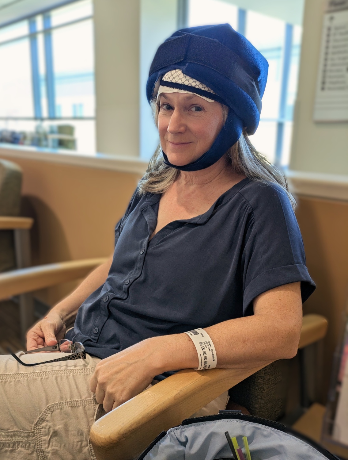
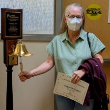
2025 was a journey. Beth started chemo right after last year's ride. My part in that phase was acquiring 60 pounds of dry ice the day before each session for cold caps. Here's a photo of Beth on the first day. The theory is that the cold prevents the chemo drugs from absorbing into the scalp, and reduces hair loss. There are several caps, and you change them every 25 minutes starting an hour before and continuing until four hours after the 2 hour treatment. Did it work? Sort of. Beth says: "I'm stuck with the photo on my driver's license [taken in November] for the next 10 years!" (I say: Lose your driver's license and apply for a new one!) But the cold mittens and booties worked really well - similar theory, though in this case entirely successful: the cold prevented neuropathy in her fingers and toes. Three months (4 sessions) later, that phase was complete. Radiation started in November, and that was completed on December 11th. She's moved on to hormone blockers which will continue that for another 4+ years. There are many typical (expected) side effects from those, and we're working on management. We had one scare in March with a drug intended for boosting bone density and reducing risk of recurrence. Like all drugs nowadays, has a list of side-effects a mile long, and she hit a rare one: iritis. Inflammation of the iris. That was treated right away, and other than a fractional loss of distance vision, no lasting effects. Whew. She has a great medical team. She's back to walking to/from the mailbox, which is 3 miles roundtrip and 670 feet of elevation gain; a stout hike. She started working with a personal trainer this week! Her hair is in a "crazy-chemo-hair" phase, and as you'll see below, it looks a lot different than even in the December graduation photo. But, in general,... things are ok, and all checkups have been positive.

We did some travel this year. We went to Portugal for just about 4 weeks in April and May. We saw the Azores via a small expedition cruise ship, spent time in Lisbon and Porto, towns in between, and 9 days exploring the Douro River Valley with Natural Habitat Adventures. In July, we celebrated our 34th anniversary in Paso Robles. In August, we went back to Churchill, Canada, this time to see Beluga whales by the 100s. Later this year, we're going to Yosemite (it's been almost 2 years) and we're doing a re-scheduled trip to the (California) Channel Islands which we had to cancel last year.

I wedged training in between. June, July, and August were big cycling months. As of today, I'm about 300 miles short of last year's pace. Training has been mixed: some really good rides, and a lot of just average rides. My climbing has been very inconsistent. I have some ideas on how to fix that; it's a work in progress.

fashion
The height of fashion!
First day with cold caps
Rad Grad
Radiation Graduation
Bell Ringing Ceremony!

A Re-Route - and we haven't even started yet!

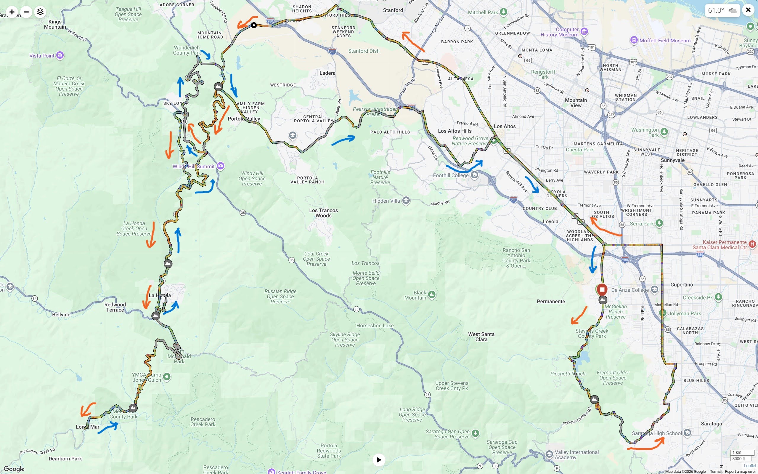
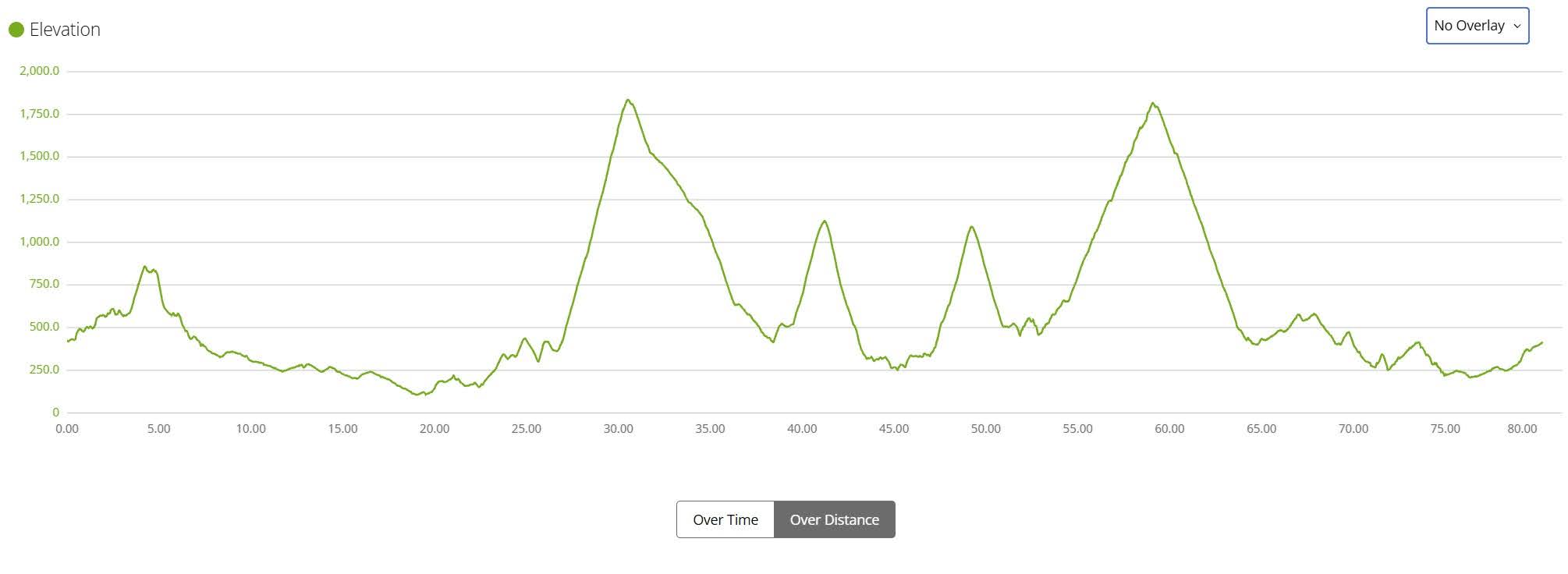
I planned a reasonable ride to match what I thought my legs could handle. My longest ride of the year to date was about 56 miles. I figured about 84 miles, with one big climb and several shorter, shallower climbs, would be about the most I could handle. The idea was to return to Kings Mountain, a climb we've done many times, add a little bonus climb around the top of Kings to make it a 2000' climb over 7.2 miles. We'd then go north on Skyline and blend in parts of the 2020 and others around the Crystal Springs Reservoir. Veteran PMC-west riders Steve, Bill and Dave planned to join for parts of the ride. All good. And then, 2 days before the ride, someone mentioned that the Kings Mountain Art Fair was also being run on Labor Day weekend - all three days, including Sunday. Kings is tough enough to climb with the occasional passing car, but we predicted chaos - maybe 5 times the typical Sunday traffic. So... back to the route drawing board.

The nearest big climb south of Kings Mountain is Old La Honda Road. We haven't used it (east of Skyline, anyway) on the ride since 2015! Then instead of going north, we could borrow more from the 2022 ride and dive down to the town of La Honda, then head over to Loma Mar for lunch, then spin around and climb back up. Trouble is... That's four pretty stout climbs, not one. Well... I've done east Old La Honda a few times this year, and the remainder of the climbs once, and it's the PMC. The route map and elevation profile are shown below. So, let's go!
 

Plan
Route map - Orange arrows are outbound, blue for return
 
Elevation
Elevation profile


The Problem With Batteries (are we riding today, or what?)

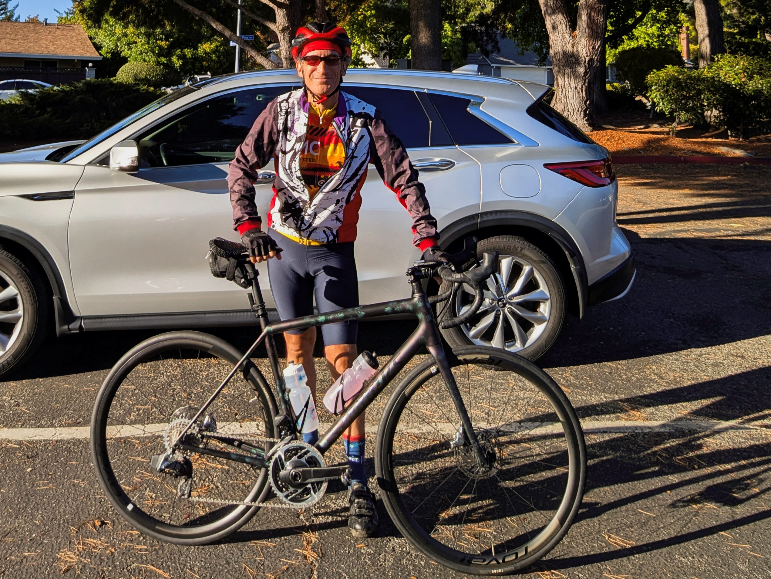
I started solo at Monta Vista Park in Cupertino. The bottom right of the map above is my Mt. Eden warm-up loop. It was chilly at the start, low 50's. I think Mt. Eden has been on the PMC-west 3 or 4 times. It's a short climb, maybe ¾ of a mile, and not really steep - perfect for a warm-up. Then once into Saratoga, it's virtually flat all the way to the meeting point in Los Altos. I started around 8:10. The plan was to meet Bill, Steve, and Dave around 9:15. Plenty of time to do my 15 mile warmup. About 3 minutes into the ride, there's a little stinger of a hill on Foothill Blvd. So, I shifted to the small chainring... and nothing happened. A second try. Still nothing. Uh oh. I pulled over to have a look. And here comes the problem with electric shifting. Of course, before the ride, I completely cleaned and lubed the bike, and charged up the rechargeable batteries - one for each derailleur, two for the blinky lights, and one for the Garmin. I checked and changed one of the 4 coin batteries. Great. Except for one thing. I left one of the derailleur batteries in the charger in the garage - D'OH!!! Some quick thinking needed. There are 2 choices here:
  1. Do the whole ride in the small chainring, losing about 13 out of 24 gears, so slower in the flats and only coasting downhill, or
  2. Beg Beth to grab the battery and meet me at the end of Mt. Eden at Pierce.
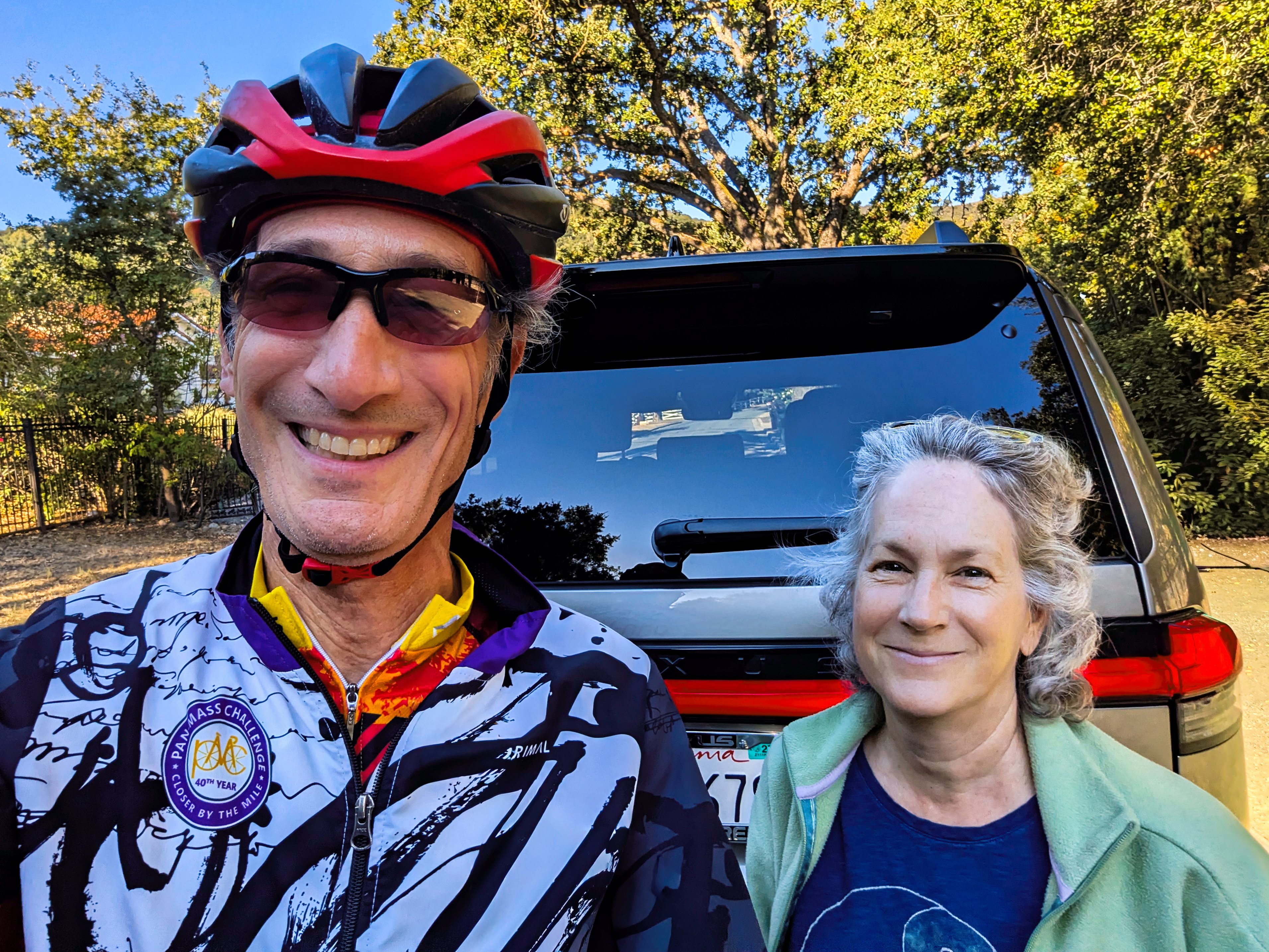
We chose the latter. I let the guys know I was probably going to be a bit late, moved the one battery to the front derailleur, shifted into the small chain ring, moved the battery back, and started riding.

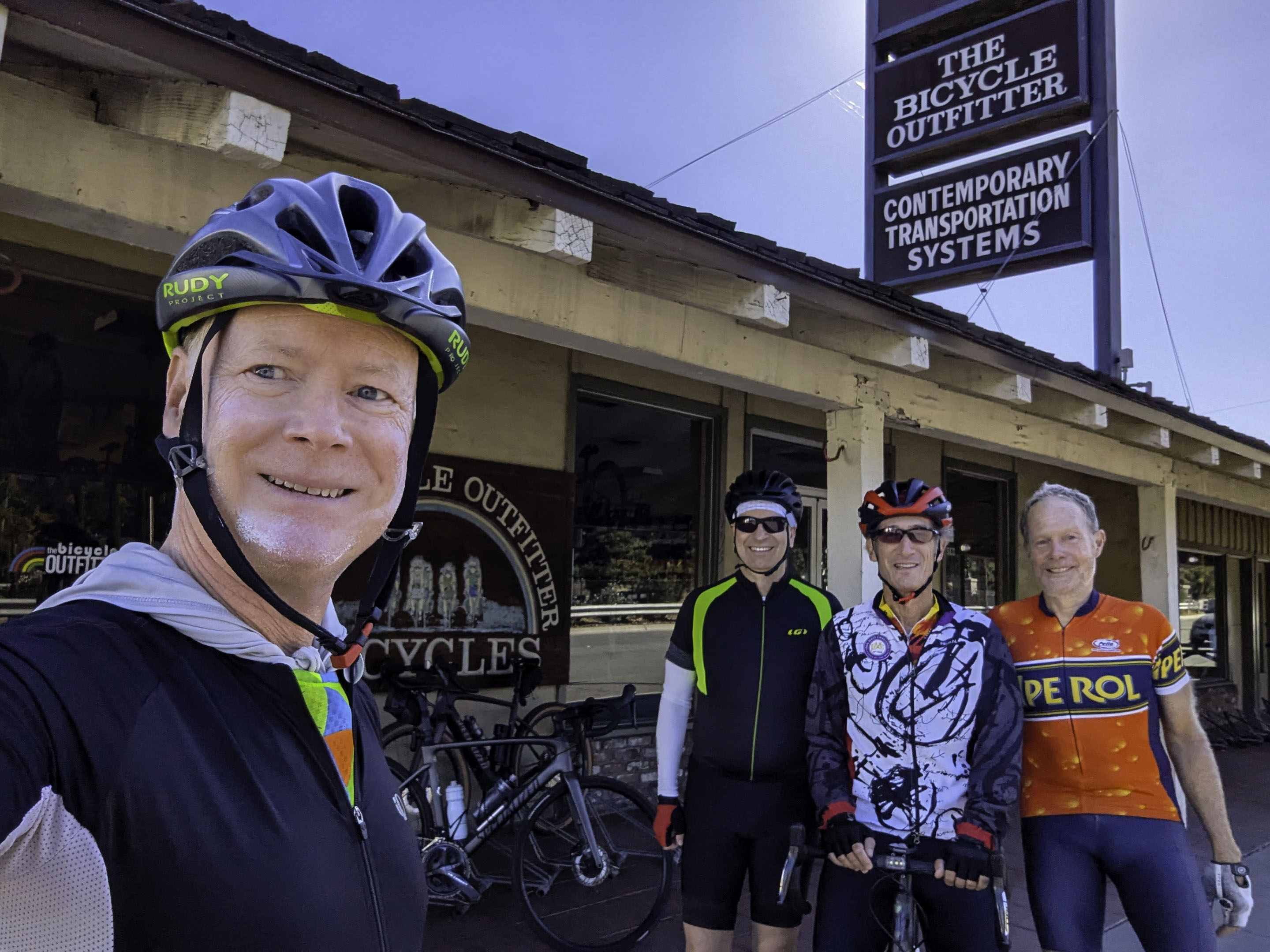
The timing was perfect. I came around the last bend at the bottom of Mt. Eden just as Beth was turning from Pierce. After many apologies, and some smiles, I put the battery in place, and off I went. Crisis averted. I did something of a time trial for the next 8½ miles, and was only about 9 minutes behind schedule when I got to The Bicycle Outfitter in Los Altos.

The Full Group Ride - East Old La Honda

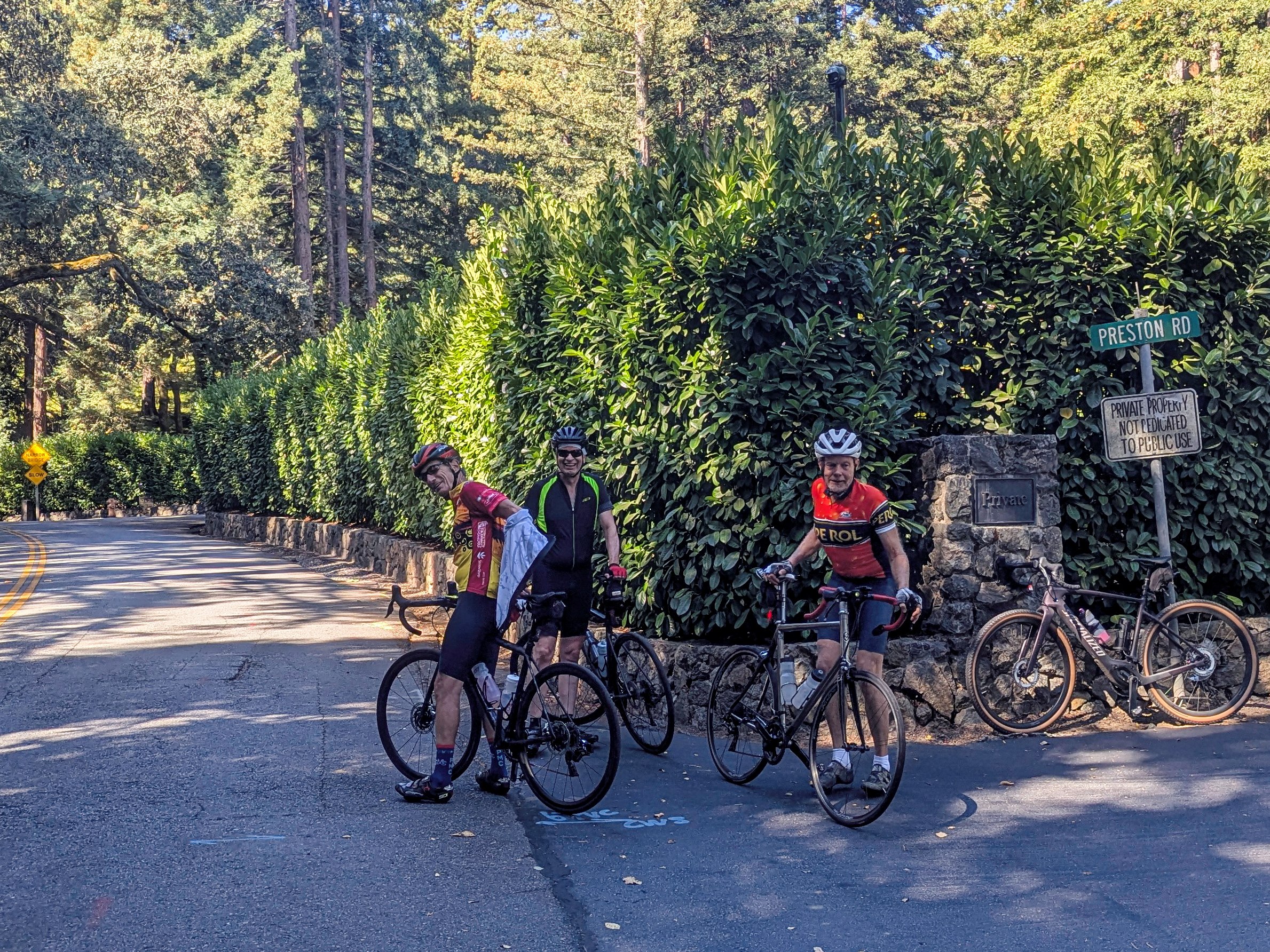
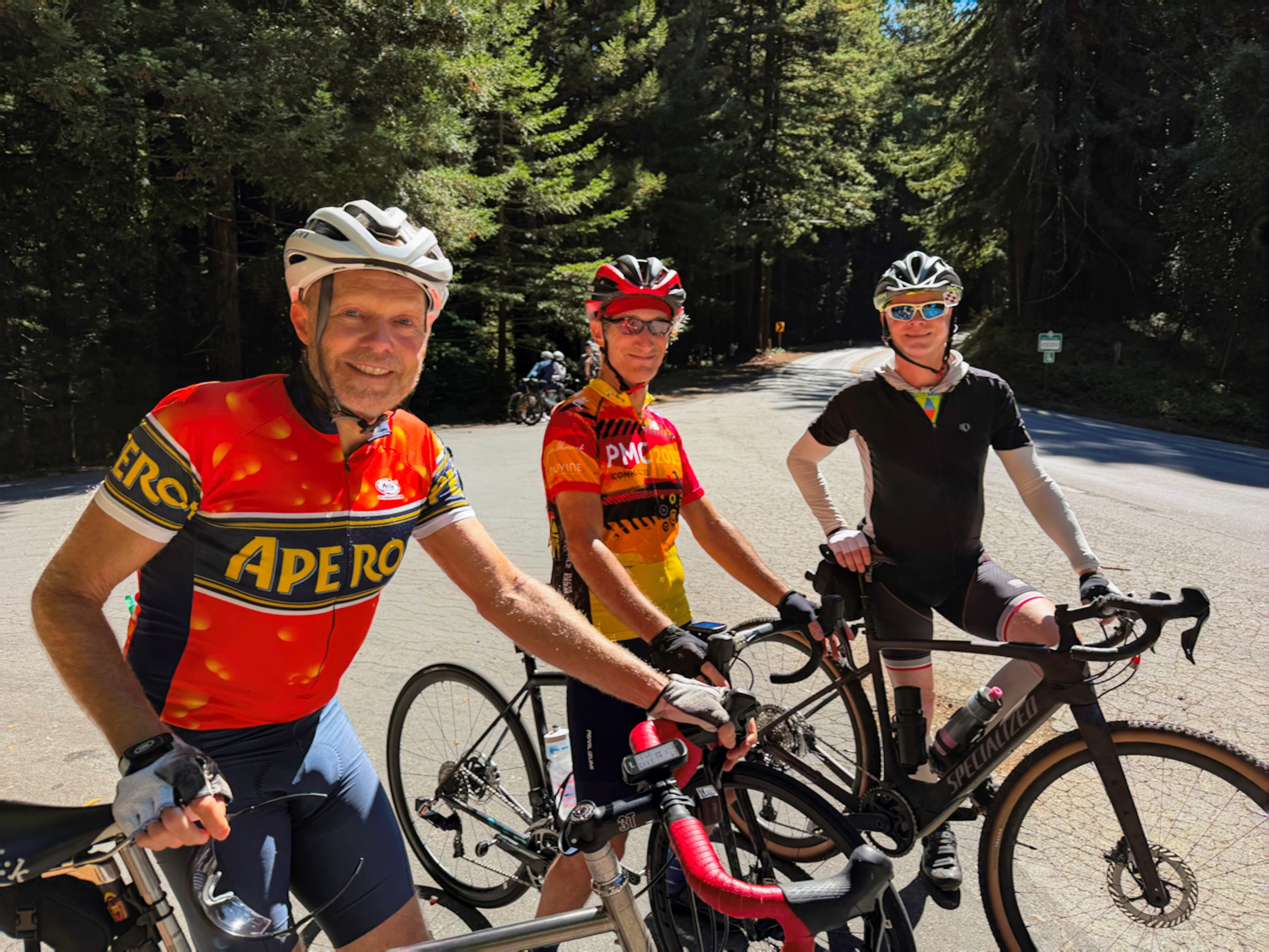
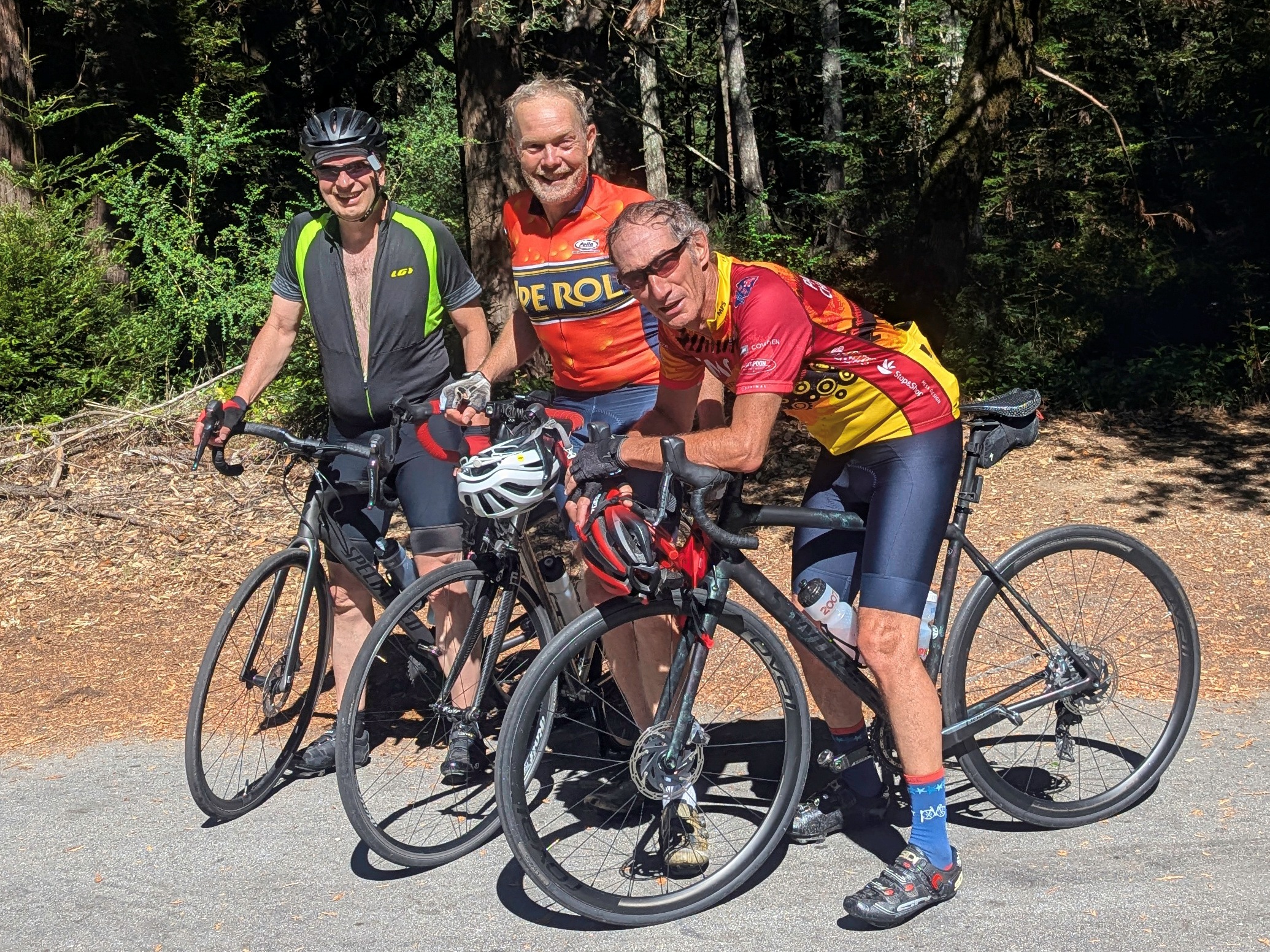
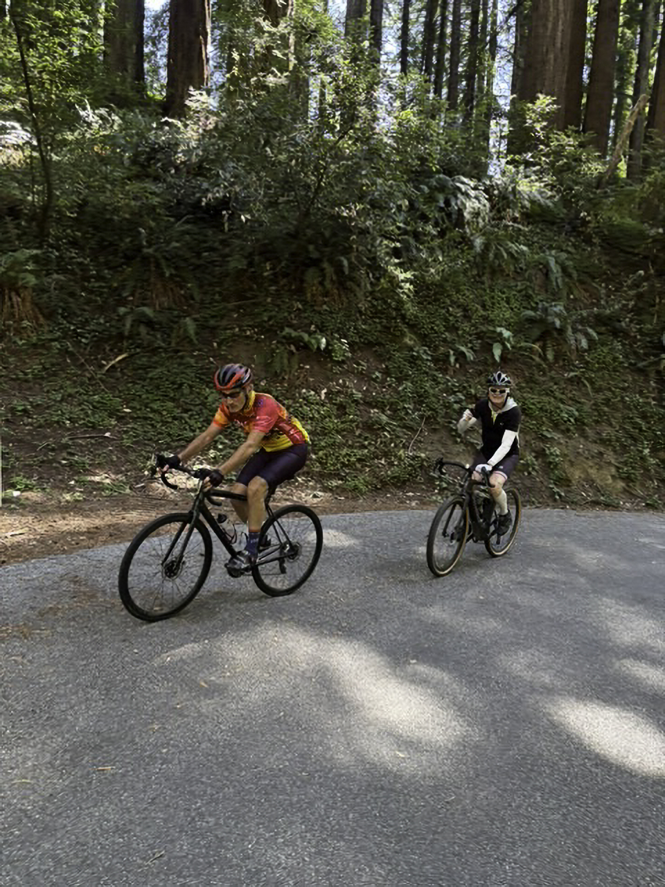
From the Outfitter, it's about 12 miles to the base of Old La Honda. It's mostly flat until Sand Hill Road near Stanford. Sand Hill is a series of 3 climbs, which get progressively shorter and steeper. I was already feeling it! But good company makes the climbs go by faster. At the base of OLH, it was a good time to ditch the jacket - it was up to 68 degrees. Steve was joking as always, so we're all smiles. Dave does this climb at least once a week, and he is very fast. We climbed at a much more judicious pace - especially knowing that this was the hardest climb of the day, and how much more climbing there was ahead. At the top, we took a few group photos. Even at a reasonable pace, it's a good sweat, a concept which Dave was keen to have captured by grabbing my headband!

Bill was turning back here. For Steve, this was a decision point. Have a close look at his new bike below (which he got at Bicycle Outfitters). It's the one leaning up against the sign post. First, it's a gravel bike - they are all the rage. Second, notice that fat downtube and huge bottom bracket. It's a Specialized Creo - an E-bike. Now before anyone scoffs at E-bikes, the bottom line is this: if it helps someone keep riding, I'm all for it. But there is range anxiety that comes along with it - no one wants to pedal 35 pounds of bike up a steep climb (recall that my Aethos is 14 pounds, maybe 15 with the tools and lights and bottle cages). But he had plenty of charge, so he decided to do the rest of the climbs. Great! We said so long to Bill, and off we went...
 

start
Start at Monta Vista
 
Batt
With Beth at Pierce and Mt. Eden -
All batteries present and accounted for!
start2
With Steve, Bill, and Dave at the Outfitter -
All riders present and accounted for!
OLH
Start of East Old La Honda
Top of OLH
Top of Old La Honda
OLH top
Good sweat!

Where to?

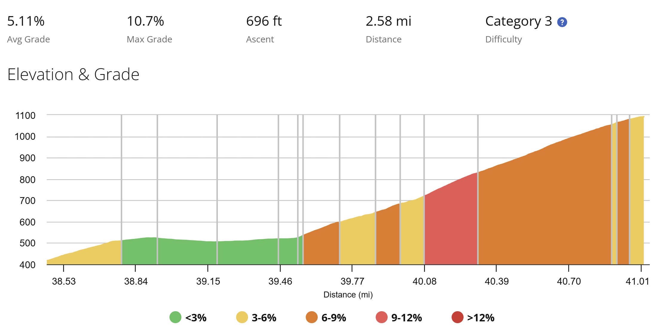
The question was: where to? I had sketched two alternatives. In both cases, we would go down Highway 84 to La Honda and to the base of Haskins Hill. At that point, we could either continue onto Alpine Road - a very tough climb (see the 2009 ride for details) with some double-digit sections (greater than a 10% grade) - or to Loma Mar which is 3 somewhat smaller climbs, but also difficult. We let food be the deciding factor, and the food is better at Loma Mar. Now we just have to get there. In this direction, it's quite nice! 84 from Skyline to La Honda is just about my favorite descent in the area. It's 8 miles from where we are, generally good pavement, not too many cars even on a weekend. Haskins Hill in this direction is only about 700 feet over 2½ miles. It climbs through a redwood forest with lots of shade. There were lots of bikes out - we passed some, we got passed by some others. We made pretty good time on the climb.

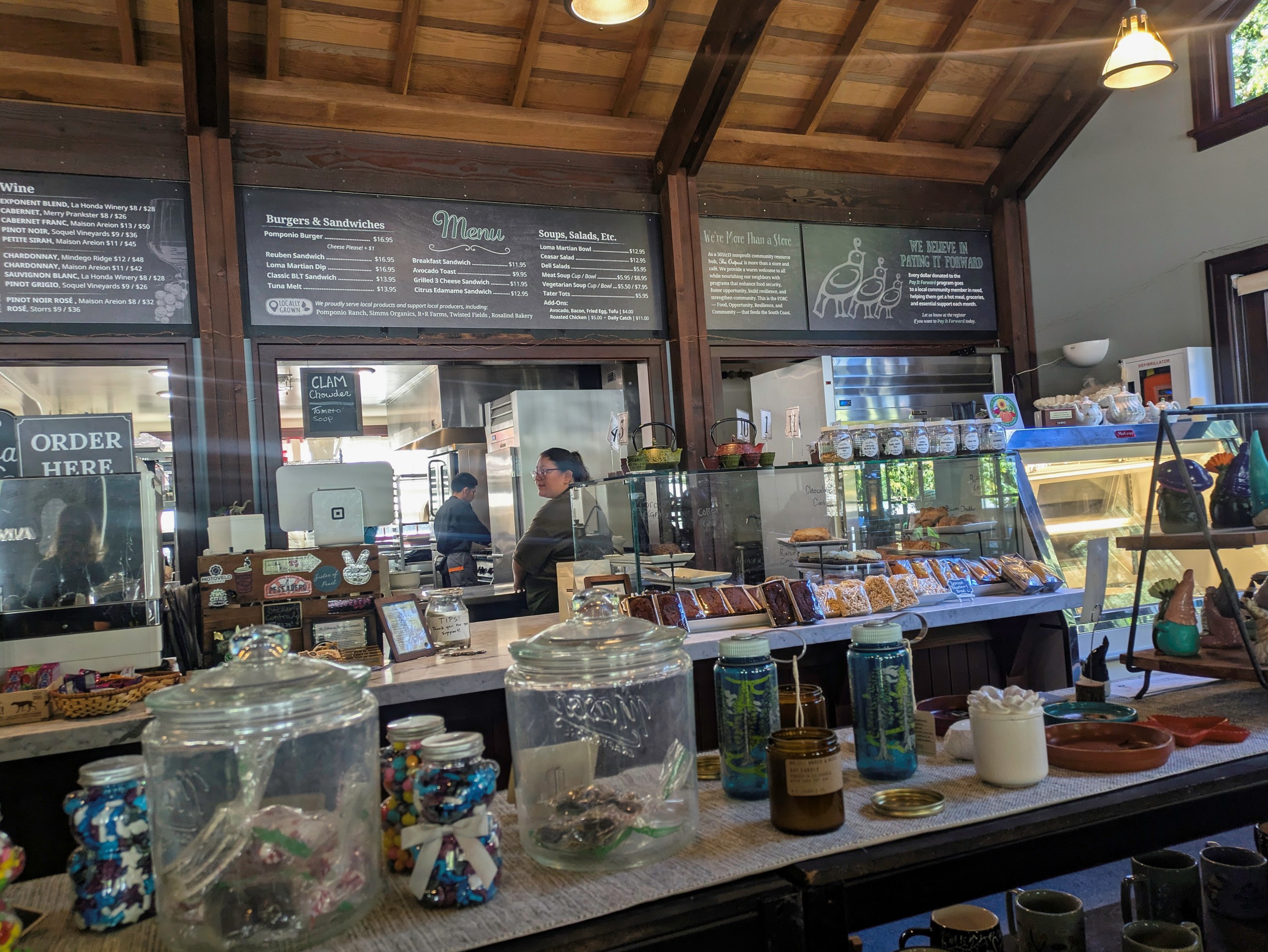
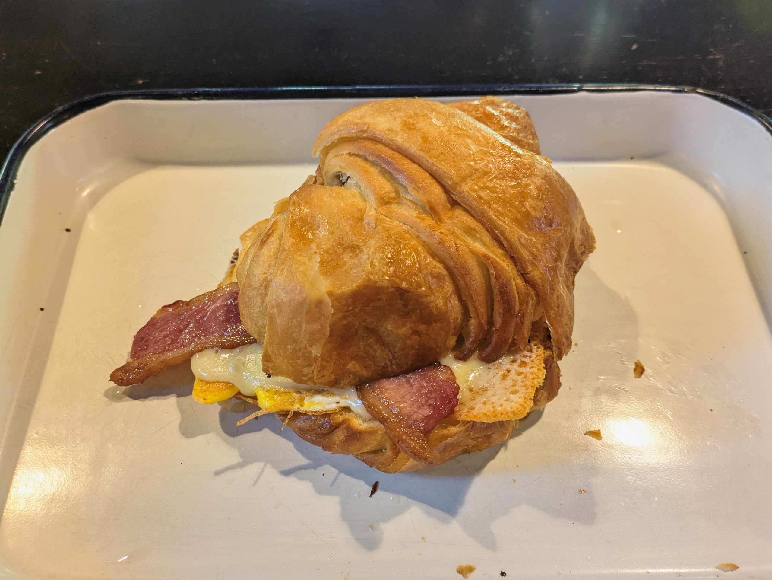
From the summit, it's 4 miles to Loma Mar. This is a tricky descent which I've only done once this year, so I applied some restraint in the corners. We arrived at the general store for lunch. We've been here before on the PMC, last time in 2022. But not on a Sunday! Wow, it was busy. I guess the word is getting out about Dave's secret lunch spot. The bike rack was completely full, so was the patio. We each had a breakfast croissant sandwich. A nice break. Now for the real work.
 
Haskins
Haskins Hill elevation, front side
Plan
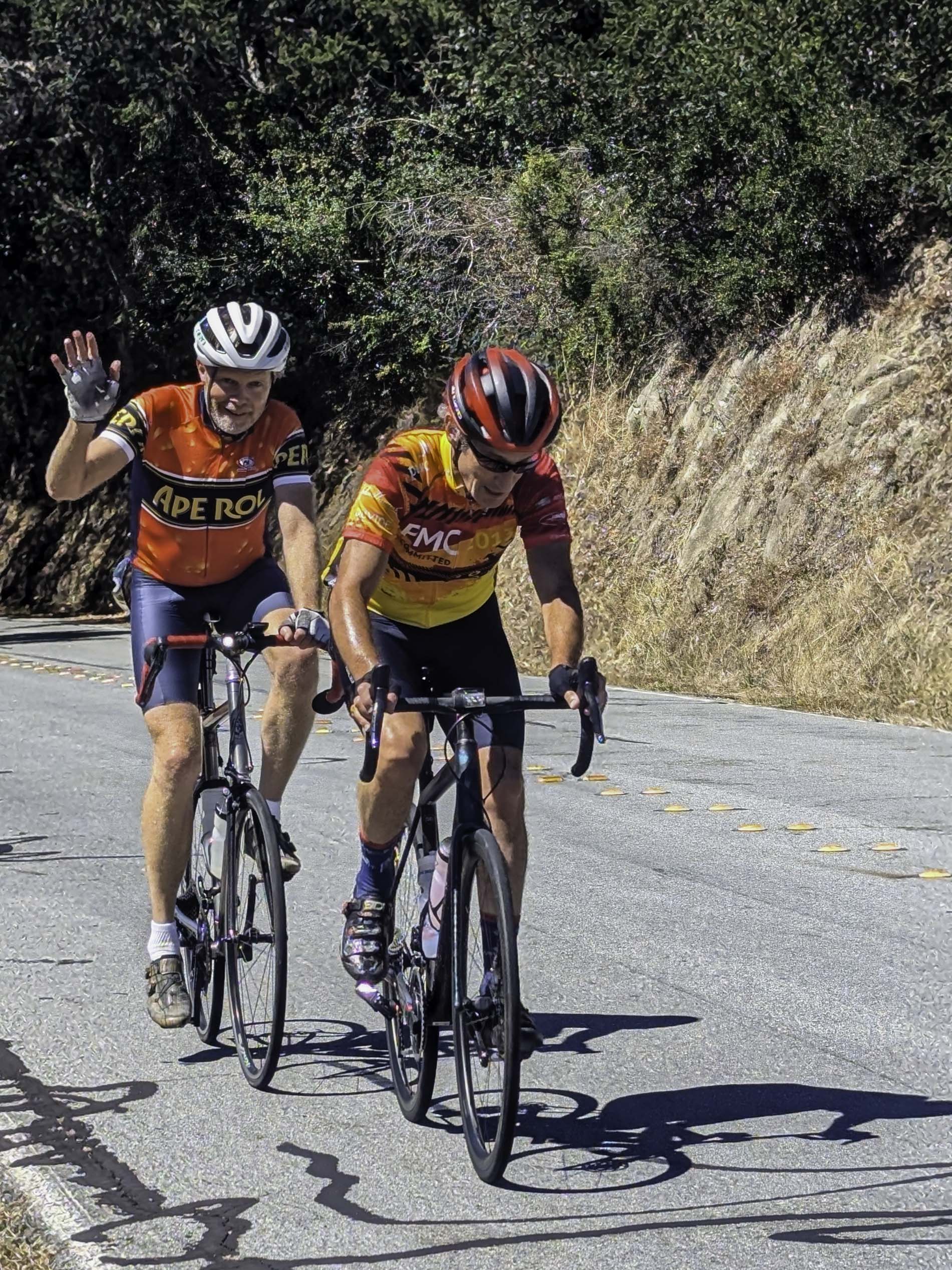
Dave and me climbing Haskins #1
elevation
Loma Mar General Store
lm2
Breakfast For Lunch

The Big Effort

We checked with Steve to see if he had enough juice... "It is what it is at this point". Perhaps the good lunch and good weather reduced the range anxiety, though we suggested calling him a Waymo if needed. Turns out there's a lot you can do with the E-bike to manage range - controlling how much boost you get, and so on. He used eco-mode where he could, and conserved. Meanwhile, there is a lot of work ahead. Coming down to Loma Mar from the top of Old La Honda is 15 miles with less than 3 miles of climbing (maybe 750 feet total). In the other direction, it's about the same 15 miles but with 9 miles of climbing and a whopping 2430 feet of elevation gain. We will easily work off the 500 calorie lunch! The only real break in this direction is descending the side of Haskins Hill we climbed to get here. You can see from the images to the right that the back side of Haskins appears steeper than the front. Maybe. It certainly feels that way. But it's all in where you measure from. Let's just agree there is a lot more climbing in this direction. Climbing is where the E-bike really helps smooth out the lumps, that's for sure.
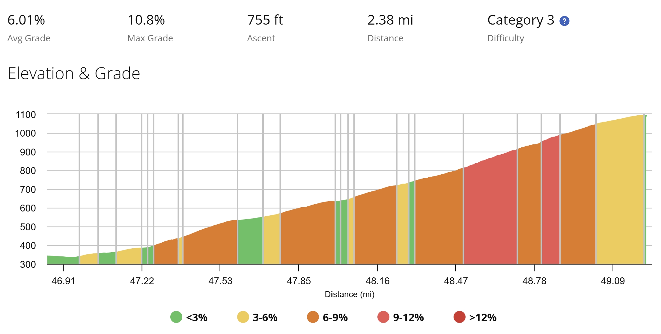
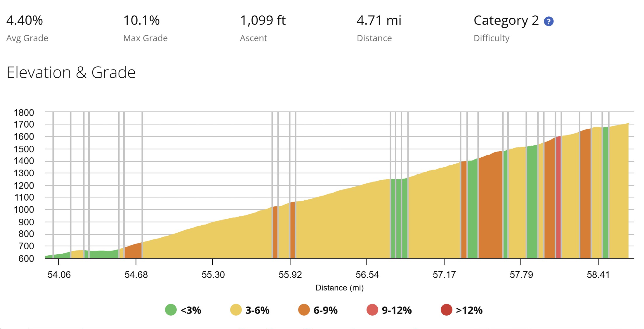
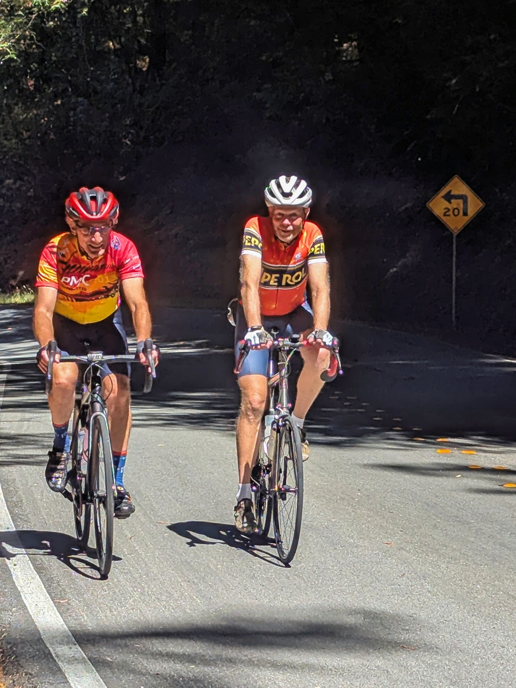
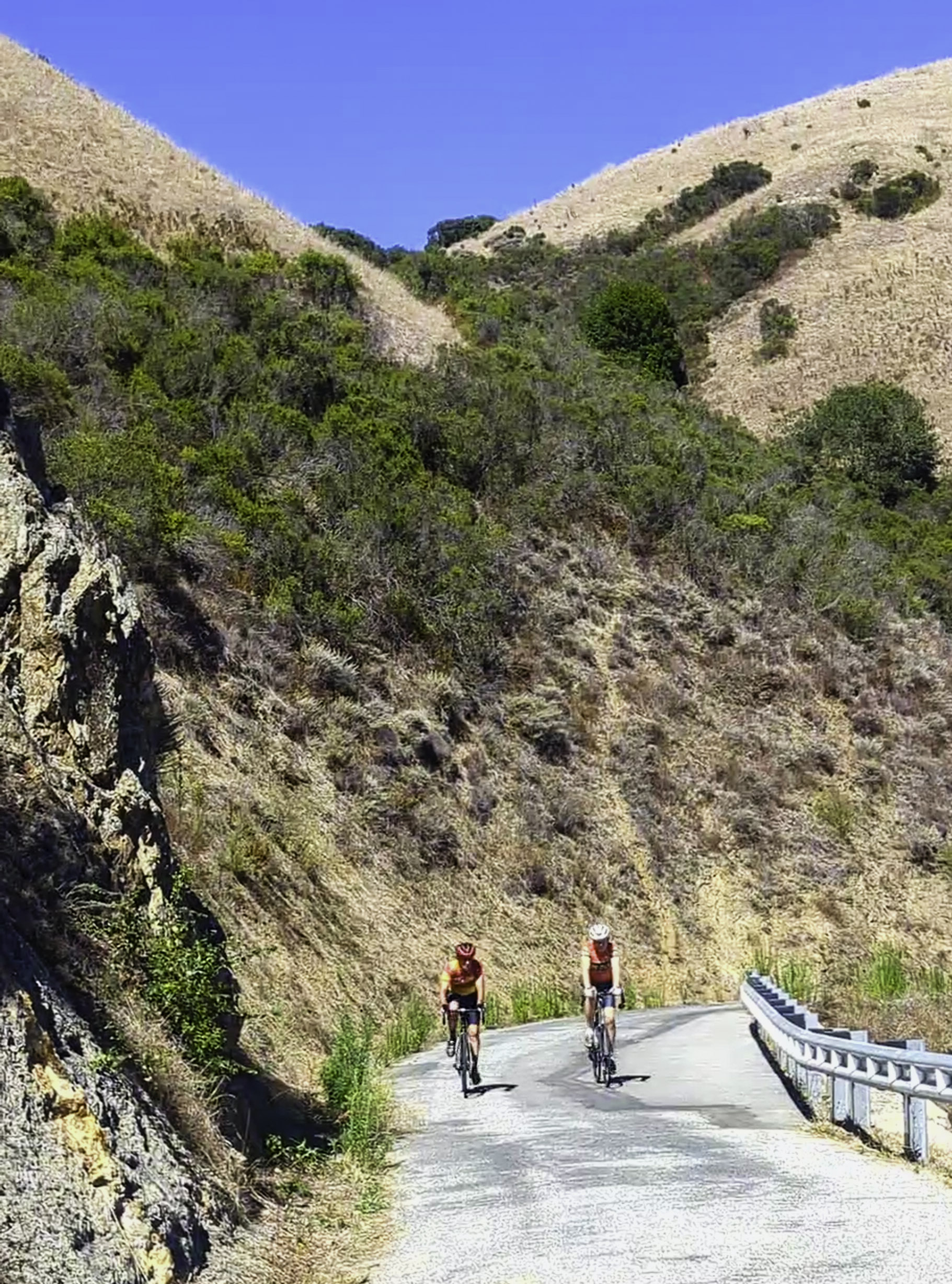
There's about 1½ miles of warm-up after lunch. Then the climbing starts. As you can see, it gets progressively steeper. As well, at the bottom, Haskins is surrounded by redwoods; lots of shade. But eventually, we climb out of the forest to a wide open sky for at least a mile. Near the top is where it's the most exposed and the steepest. Steve was able to boost his way ahead and get a good photo of Dave and me cresting the steepest section. It had warmed up a bit - about 78, so another good sweat (for me!), but not hot. Still very nice. Over the top, we descended what we climbed before lunch. Dave does this ride a lot - he pointed out a few whoop-de-doo's in the road, very handy to know when they are coming when you're descending at 30+ mph. Back on Pescadero Creek Road, rather than go back exactly the way we came, we did a little bonus climb on a very pretty one-lane residential road under the redwoods just before 84. This also allowed us to rejoin 84 in a spot that has a wide shoulder.


Has2
Loma Mar back to the top of Haskins
 
Big climb
From La Honda to Skyline
Haskins2
Climbing the back side of Haskins
View
About half way up West Old La Honda
View
The View from West Old La Honda
Summit
Into the Redwoods near the top
of West Old La Honda
 

Ups and Downs

What comes down must go back up. Once back on 84, there's about 1½ miles through the town of La Honda that's flat to rolling - maybe 2% to 3% grade - leading to the 2nd most difficult climb of the day. Ahead is 2 miles on the highway, then 2½ miles on West Old La Honda Road with about 1300 feet left to climb. I managed to get myself out front and set a consistent pace on 84 before we turned onto West Old La Honda. There's not much shade here until the last mile - sort-of the inverse of the Loma Mar to the Haskins summit climb. Steve zoomed ahead again to get a photo of Dave and me climbing with about a mile to go. Soon after that, we got to the edge of the redwoods, some welcome shade, and flatter slopes. Dave took the opportunity to zoom ahead into the woods and get the photo of Steve and me in this section. The last 100 feet before Skyline is a real stinger, but it's short. Overall, it was a pretty good climb!

We've got about 20 to go, mostly downhill. We decided to ride along Skyline back up to 84 to descend down into Woodside rather than retrace the route and descend East Old La Honda - OLH is almost all one-lane, very technical, and really not a fun descent. 84, on the other hand, can be fun. It's moderately technical in spots, but wide. The intersection of Skyline and 84 was jam packed with cars parked in every available pull out and patch of dirt. Apparently this was some sort of off-site parking with a shuttle for the Kings Mountain Fair. Really glad we did not go the original route. Once descending, we were passed by only a few cars until the turnoff to Portola Road. A nice smooth descent.

Dave trailed off in Portola Valley to head home. Steve and I did the typical route from Arastradero Road back through Los Altos Hills and onto Foothill Expressway - Steve trailed off in Los Altos, back to the Outfitter. I had originally planned a few bonus climbs off Foothill - about 5 or 6 miles and 500 feet - but my shoulders and lower back were really sore! So I kept to the simple, direct route along Foothill back to Monta Vista Park. All told, the ride was a little over 80 miles, with 6800+ feet of elevation gain.

Post Ride

Simply stated, the ride was really nice. The re-route worked out well. The route was about 20 miles and 2000 feet more than my longest ride of the year. The weather was outstanding. You could not ask for better weather - other than some fog on the horizon, not a cloud in the sky. We didn't (really) have any mechanical failures, unless you count the battery goof. (I've got a plan to make sure that doesn't happen again.) I certainly learned a lot about E-bikes! Everyone got in a lot of good miles. A lot of story telling. A lot of laughter. A lot of good smiles. I am very thankful to have had such good company.

I've raised over $18,000 so far, thanks to my fantastic sponsors. The goal is $20k and I believe we can do it. We've got a few months.

As mentioned, Beth is doing ok. Cancer is not one-and-done; very often it calls for years of testing and followups. And in just the last 6 months, we've had 5 friends and family dealing with various types of cancer. It doesn't end. The PMC has an impact page which is a really good look at how PMC-raised funds are distributed within DFCI. It's critical research - DFCI led the landmark trial for Beth's chemo protocol! We need to keep funding places like DFCI so they can keep advancing cancer treatment.

As the PMC says, there's a lot riding on us. I'm glad to have done my part for 36 years, and so thankful to have a growing group of sponsors that fund the PMC and DFCI.

Thank you all SO MUCH for your support!


Return to my PMC home page