The 2025 PMC: Lemons

August 17, 2025

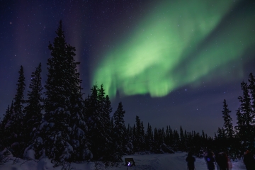
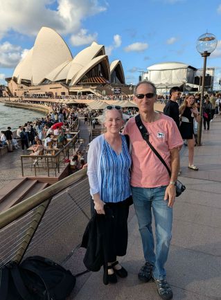
There's an old saying about lemons. When life gives you lemons... well, you'd better like lemons. It's been that sort of summer. The year started off well - decent weather, good mileage on the bike. Some great vacations - Churchill, Canada for northern lights in January, and 5 weeks in Australia for April and May. We returned on May 22. I've put in over 1100 miles since, about 2100 total, which is a bit better than last year. By mid-June things were looking good.

And then, Beth was diagnosed with breast cancer. The purpose and meaning of the PMC was personal again. From the start, the outlook was good, and that was later confirmed: a relatively early catch, stage 1A, post-op clean margins and no spread to lymph nodes. All good. The only wrinkle was that the type of cancer would benefit from chemotherapy, that is, adding CT would reduce the chance of recurrence. That's where we are today. CT starts next week. It's going to be a bumpy road, but we will adapt and overcome. We'll make some lemonade.

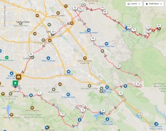
So, it was time for a really hard ride. The goal was 100 miles from Los Gatos to Morgan Hill and San Jose, and back. This is basically a blend of parts of the 2012 and 2016 rides. Some pretty serious mountain climbing. Here's the map and the planned elevation profile below. The significant climbs are Kennedy, Hicks, Metcalf, and a visit back to the three steps up Mt. Hamilton. Look how tiny Hicks looks in comparison to Mt. Hamilton! Cycling climbs climbs are categorized from 5 (easiest) to 1 (hard) to HC (beyond categorization, the very hardest). I had considered different routes that included HC climbs, but it wasn't clear I could complete any with my current fitness level. So perhaps I'll do one in the fall as a bonus ride. Regardless, it's a stout set of climbs: category 4, 3, 3, 1, 3, and 1 with a bunch of 5's mixed in. Plenty of climbing for all.

I mapped out many potential water stops along the way so I would be well hydrated. And, of course after a complete energy loss on Hamilton back in 2016, I would carry lots of calories, and I planned an all-important lunch stop before Mt. Hamilton. Originally, I planned to ride on the 9th, but I had some back issues, and it was forecast to be in the 90s. This weekend's weather looked much better.

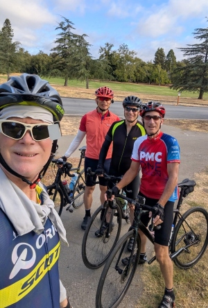
This year, I had lots of company at the start! We started with 4: myself, Steve Meier (back after a few years hiatus), Bill Mullen (first appearance since 2009!), and newcomer Dan Chan. Steve, Bill, and Dan committed thru Hicks at least. The forecast was for a high around 75 mid-day on Mt Hamilton.

Now, LET'S GO!

Aurora
Epic Northern Lights
 
Sydney
Sydney Opera House, April, 2025
 
Plan
Route map
 
Elevation
Elevation profile


Los Gatos to Almaden/Quicksilver: Kennedy and Hicks

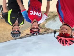
I was expecting cool and potentially drizzly weather at 8AM at Vasona Lake County Park in Los Gatos. Instead it was sunny and about 71°. Hmmm. I was already wondering if the weather forecast was a bust. We'll see. I was sporting the 2024 jersey, when the PMC passed the $1 Billion mark. I mounted the Gopro on the bike to capture some of the days climbs, met the team, got a start photo, and we were off. There's only about 2.5 miles of warmup before the first climb. Kennedy Road goes east from Los Gatos, climbing through the shaded Shannon neighborhood. The climb itself is short - about 1 mile, with a maximum grade of about 13%. Steve would call it a stinger. Certainly a taste of things to come. After a short descent and a few right turns, we're on the flat part of Hicks Road.

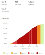
There are a few ways to look at Hicks. It's either 5 miles with an average grade of 4%. Or you can (and should!) look at it as 2 discrete steps. The first step is about 3.5 miles with a mostly shallow grade and one very short steep climb up to the Guadalupe reservoir. I went to start the GoPro and no-go. Doh. I charged it the day before, but oh well. (If you'd like to see what it's like to climb Hicks, Metcalf and Hamilton, there's a really strong rider who did this ride (and then some) and posted a YouTube video of it, which I queued up to Hicks for you.) We regrouped at Guadalupe and started the hardest climb of the day. Hicks is a short-ish climb at 1.25 miles, so it's only a category 3. Overall, it averages 12%, but the middle 3/4 mile is where it's super steep, topping out at 17%. That's steep. It was not hot - about 70° - but the sweat just pours off ya. It's a lot of work, but it felt good. Where was Steve? I went back down a ways and found that he had gotten a flat tire with about 1/3 mile to go - nothing worse than a flat on a steep climb. He walked it up and I got in a bonus climb. We did a pit-crew tube change.

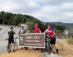
We got a hiker to take the photo of us below with Mt. Umunhum in the background. The concrete block at the top is an 85 foot tall ex-radar station, and is 2.2 miles away (5.5 road miles). Some Mt. Umunhum history can be found at that link. I had thought about adding Umunhum to this ride. It is a relentless climb: 4.5 miles at 10% without a break, having just climbed Hicks. Eh, maybe later. Due to the flat, Steve decided to turn back for the shortest path to the car rather than follow the original loop plan from the east side of Hicks. And then there were three. Some patches of blue allowed the sun to peek through the clouds. It felt like it was warming up faster than expected. But there's nothing like a -9% descent to cool you off. Hicks meets Alamitos Road by the Almaden Reservoir and this starts one of two flat sections of the course. We had a quick water stop at the Almaden Quicksilver Park. It's handy that Santa Clara County Parks has proper water bottle filler fountains in many of their parks.
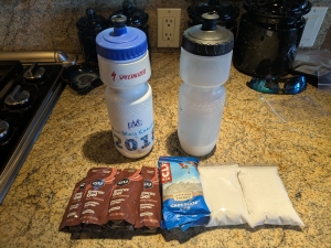
 

food
That's 1700 calories!
 
Vasona
Starting from Vasona Park in Los Gatos
 
Hicks elevation
Hicks Elevation
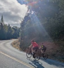
Dan/Bill/Hicks
Dan and Bill on the
steep part of Hicks
Hicks
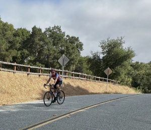
Cresting Hicks a second time
 
Plan
Top of Hicks
 

Metcalf and Lunch

Leaving Almaden/Quicksilver, it's pretty flat for a while. The road runs through the town of New Almaden along the Alamitos Creek. It's easy to keep the pace up here. At McKean road, I expected Bill and Dan to loop back towards Los Gatos, but they decided to add some bonus miles. Great! Onto McKean Road, we turned back southeast and picked up a little headwind. Dan pulled us through this section, keeping a reasonable pace. McKean can be a little busy, but it was not too bad, perhaps due to the now completely overcast skies. The fog and low clouds seemed to be moving around. The route stays on McKean for only 4 miles before the left on Bailey to head towards Metcalf. A nice bonus was that Bailey appears to have been repaved recently and it was totally smooth. After a short shallow climb, Bailey descends at a reasonable 5%, and with the smooth pavement, this was a zippy segment on the outskirts of Morgan Hill. We crossed over US101, and entered the foothills before Metcalf. This is where Bill and Dan decided to head back. It was great to have their company for 8 extra miles. They were both really riding strong in the first 25. I got some quick calories, and headed out for the remaining 75 miles solo, starting with Metcalf.

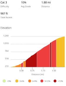
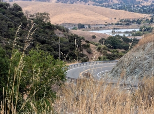
Metcalf has appeared on my PMC at least once before. It's a similar climb to Hicks, also a category 3. At 1.8 miles, it's longer, but the average grade is a little less at 10%. I think this is my 4th time up Metcalf - it hasn't gotten any easier. I managed to get a quick photo looking back down from about 1/4 of the way up just before the super steep section. The sun had disappeared again, and it was a little on the humid side. A good sweat. The road surface was really good - we got lucky with the roads. These are nothing like Eureka Canyon from previous years. At the top of Metcalf is another water stop at the Metcalf Motorcycle County Park for dirt bikes - a busy place on a Saturday but, like Almaden/Quicksilver, with easy access to another proper water bottle filler. It was interesting to think that I had only done 29 miles and 1/3 of the climbing. It's gonna be a long day. About 16 miles to go until lunch.

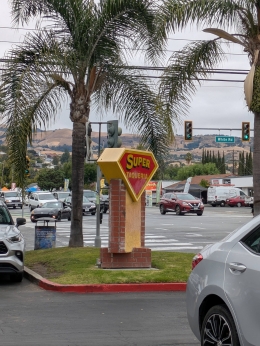
From the top of Metcalf, it's a spoon for the next 4 miles - downhill to start, then a little stinger climb on San Felipe Road. After that, San Felipe (in this northwest direction) is a really good place to make up time. A long shallow descent into San Jose, easy to keep the speed up in the mid 20s to low 30s. I was definitely hungry for real food. Once back in the city, San Felipe becomes White Road, and there sure are a lot of traffic lights! And I seemed hit many of them. One of them was the intersection with Quimby Road. Quimby is one of the hardest climbs in the bay area, going up the west shoulder of Mt. Hamilton. Some other time! I got to my Super Taqueria lunch stop around 12:15. Of course, I had a super chicken taco (and a chocolate Gu for desert). As you can see, it's more overcast here in East San Jose. It was up to about 75°. As I was a little behind schedule, I didn't dawdle and got back on the road in under 15 minutes. It was about 3 miles to the start of Mt. Hamilton Road, though the climbing starts maybe half a mile before that.

58 miles and 5000 feet to go.
Then1
Metcalf looming just around the corner
elevation
Metcalf profile
Metcalf
A look back from part way up Metcalf
 
Plan
Super Taqueria
 

Mount Hamilton

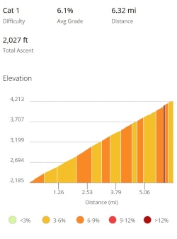
I selected a slightly lower-traffic path to the start of Mount Hamilton road parallel to Alum Rock Ave (which can get pretty busy). Whether McKee Road or Alum Rock, you pretty much climb as soon as you turn right off White Road. After a little zig-zag on Alum Rock, I was on Mt Hamilton. Overall, it's nearly 19 miles to the top, with 3 climbs totalling 4500' of elevation gain (the observatory is at 4209 feet, but there are two descents on Hamilton). My goal was simple: conservative and consistent from bottom to top, and not to run out of energy. The first climb is a category 1. It's not particularly steep at 5% average, but it is long - 6.6 miles and almost 1700' of gain. It has a section about 4 miles in which is just about flat. Traffic was very light - even lighter than I expected, perhaps due to the overcast conditions. I hammered out a reasonable tempo with a long way still to go. The first climb done, there's a 2 mile descent to the Joseph D. Grant county park. This was an optional water stop but it was cooling off - down to about 68° - and I still had plenty of water. Note to self: drain these bottles by the top of the next climb!

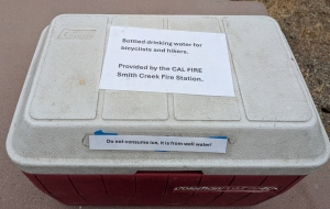
I was starting to feel the work of the day in my legs and my lower back. But nothing to worry about. The second climb on Hamilton is only a category 3 - short at 3 miles, a little under 5% average. Once again, consistency was the goal. I emptied both bottles and after a short descent, arrived at the Cal Fire Smith Creek Station. These guys are known for leaving water out at their picnic table for cyclists and hikers, very nice. I checked in with the crew, talked shop for a bit, thanked them for the water, and started the 3rd and final - and most difficult - climb on Hamilton.

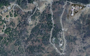
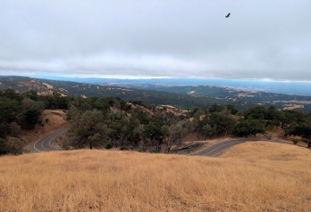
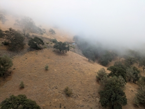
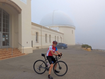
This last climb is my nemesis. Recall that back in 2016 I crumbled on this climb, running out of energy half way up and creeping the last 3 miles. I was intent on not repeating that mistake. Sticking with the themes of the day, I took on 300 calories at the Cal Fire water stop, climbed at a reasonable and consistent pace, and stayed hydrated. Periodically, I tried to stretch out my lower back and left calf. It was getting cooler as I made my way up this last 6.3 miles and a little over 2000' of elevation gain. It looked like the fog and low clouds were increasing in the general direction of the summit. Photo op! I took 2 photos with about 2 miles to go: one shows a bit of the road already traveled back towards San Jose; the other, looking up towards where the Lick Observatory should be. I arrived at the summit, tired and a little sore, but I had pace right to the top of the climb. There was hardly anyone there. A motorcyclist took the photo of me below. You can barely see the dome. A comment I've made in the past is that on this part of Hamilton, you can see the observatory from a long way away, but you never seem to get any closer to it. Today, you couldn't see it until you were in the parking lot. I think that helped with ride psychology. Another plus was using the "course" feature of the Garmin, which shows the climb profile and how much is left. Knowing what's up ahead can help you plan your effort.

Having made it 65 miles to the highest point in the bay area, now I just have 35 miles to go. Mostly not climbing.


Ham3
Last Hamilton Climb Profile
 
Smith
Cal Fire Smith Creek Water
Nice!
View
Satellite map of the top 2 miles
of Mt. Hamilton Road
View
View back down Mt. Hamilton Road at some switchbacks.
Notice my good-luck hawk?
Fog
The Dome is up there somewhere
Summit
Foggy and 60° at the Observatory
 

Descending Hamilton and Getting Across San Jose

It took a little over 2 hours to climb Hamilton. It's been a very long time since I descended Hamilton. Heading back down should be a fun reward after such a hard climb, so I went for a conservative pace, especially in the top section which is fairly technical. One thing about newer bikes with disc brakes: they sure are noisy. I did notice this watching the Tour De France in July. So it's not just me. Anyway, I was back at the Cal Fire station in less than 15 minutes! Loaded up on water, and on the way.

Now remember those little descents on the way up? Guess what? They're climbs on the way back. This first one is really just a bump, followed by the second out of 3 descents. At the bottom, I was back at Grant Park and the start of the last climb of the day! It's only category 5, a 4% grade over a mile and a half. Some cyclists passed me at the bottom of the climb. I caught up to them, mostly to find out where they came from. They had started in Livermore, and climbed the back side of Hamilton. That's a different 100 mile loop I'd like to try someday. I tried to stick with them for a while, but tired legs and tired lower back slowed me down on this last climb.

The last of the descents is the least technical. Now down to a reasonable altitude, it had warmed back up to mid-70s. So I picked up the pace. With no traffic, it was a really fun, fast, swoopy descent, and I was back at Alum Rock Ave about 58 minutes after leaving the summit. There's still a mile of descending down Alum Rock until it intersects with White Road again. After that, it's virtually flat for the last 15 miles.

It looked so simple on the map: cut across San Jose to the southwest, get on the Los Gatos Creek Trail. But perhaps not so simple. The first few miles went pretty well. Right up until San Jose State University. Then the Garmin seemed to get very confused. It kept trying to get me to make turns into "trails" or "cycleways" which did not exist. I finally pulled over at a bike shop, and asked a mechanic how I could get to the Los Gatos Creek Trail. I plugged his directions into the phone, no longer trusting the Garmin. This went pretty well - there was just one street that's not super bike friendly. There were even some signs directing to the trail. And I found the entrance... And it was closed for construction. D'OH! I looked at the phone maps, even called Beth so she could look around on a big screen. And another cyclist showed up and he looked at his phone. Then we looked a little closer at the sign describing the construction project. It had a detour posted. I told Beth nevermind and rode around the block, maybe a quarter of a mile, and got onto the trail. Finally.
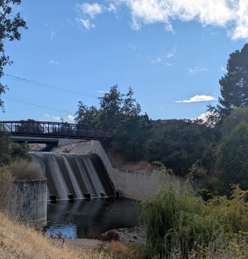
The remaining 6 miles of the ride was uneventful. I've never ridden on the Los Gatos Creek Trail, it's pretty nice. Lots of people out - walkers, runners, bikes of all kinds. The late afternoon sun was out, and it was about 78°. I pulled into Vasona park, satisfied to be done after a solid day's ride. I called Beth straight away, and headed home.

LGCT
A Bridge on the Los Gatos Creek Trail
 

Post Ride

Simply stated, the ride worked out well: 101.25 miles, about 9200' of elevation gain. This was the most climbing I have done since the 2014 ride across Yosemite. The weather was really good for a long hard ride. Not too hot, not too cold. I followed my plan to stay hydrated and keep the calories up. After 7 water bottles (1.3 gallons) and 2100 calories... I managed to lose 3 pounds! That's a lot. I had great company at the start. Steve did a bit over 20 miles and 2100'. Bill and Dan ended up doing 48 miles and over 3000'. It was just a good day's work for everyone.

I've raised over $18,000 so far, thanks to my awesome sponsors. The stated goal is $20k... but secretly I'm aiming for $23k or even higher. I believe we can do it with your help.

So, what's it all about? As mentioned, Beth starts chemo in a few days. She has 4 sessions on an interval of 3 weeks, followed by radiation, with the intent of reducing the risk of recurrence to as close to zero as possible. I cannot even imagine what this will be like. I was tired and sore the day after the ride, but recovering fast. I can only hope it's the same for Beth. The good news is how much has changed in 35 years since I started riding the PMC. Chemotherapy has evolved a lot in that time so that there are now 100s or even 1000s of different personalized regimens. Long gone is the one-size-fits-all approach. Dana Farber is actively involved in breast cancer research, including the development of new therapies, early detection methods, and personalized treatment approaches. I'd like to think that somewhere along the way, their research contributed to the pool of data that our excellent care team has used to help shape Beth's treatment. And the research and trials happen with funding from you.

As the PMC says, there's a lot riding on us. I'm glad to do my part, and so thankful to have a growing group of sponsors that fund the PMC and DFCI.

Thank you all SO MUCH for your support!


Return to my PMC home page