One of my goals when I retired last August was to ride more. So this year, I logged about 20% more miles than last year. Lots of this year's rides were in the 50-65 mile range, with plenty of climbing. With the exception of one overtraining event in mid July, I was feeling good. So what route would it be for this year's PMC? It took a while to dial that in. It's been very hot here so ideally, I wanted to incorporate the coast and shade. That ruled out Mt. Umunhum and other climbs around San Jose. San Mateo County climbs like Kings Mountain and Tunitas Creek are shaded. I've been climbing Kings a lot recently, and that hasn't been on my PMC since 2009. Tunitas hasn't been part of my PMC since 2015. So maybe a variation on the 2015 ride? Last year's ride was a very tough ride for good reason, but if you look at its elevation profile, you can see it was very back-end loaded - most of the climbing was in the last 35 miles. This year, as you can see, I shifted it so most of the climbing is in the middle of the ride. Two big climbs, seven total. The route and the elevation profile below are actual data from my Garmin.
|

|
Route map
|
|

|
Elevation profile
|
|
|
There was a lot of planned road work along this route starting August 29, so we had to get this done before then - we penciled in Thursday, 8/25. I was hoping to get both of my recent PMC-west riders to join. Dave was available and ready to go, but unfortunately, Steve would be away on vacation for that week. And then two weeks or so before the ride, my trusty BMC bike started having some drivetrain problems. My usual bike shop was backed up for repair appointments; oh no! But on my last training ride, 2 days before the big day, I popped in at a local bike shop and they were able to do a quick derailleur adjustment. This was very important for two reasons: it's really important to stay in gear while climbing, and Dave really likes a quiet drivetrain! 
|
Let's Ride!
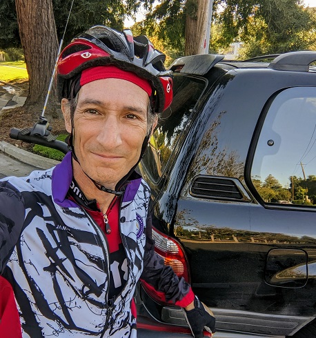
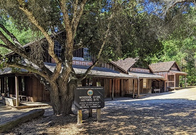
I started the ride from Los Altos at a leisurely 9AM. Temperature was mid 60s, a break from the heat. Here, you can see that I do not know how to take a selfie. Riding around Foothill College and up Taaffe Rd into Los Altos Hills was designed as a warm-up climb to test my legs. The first descent down Page Mill is always fun, then a left through the Arastradero preserve led me to the meeting point with Dave on Alpine Road. Continuing into Portola Valley, it's mostly flat to the start of Kings Mountain. There's a nice stop for water just before the climb at the historic Woodside Store museum. Then we climb.
Kings Mountain Road is a bit over 4 miles at 7.5% average grade. It's fairly consistent though there's a 9.2% section in the middle. It's shaded for about 70% of the way, in many cases with mature redwoods. It's a pretty road, and there's almost no vehicle traffic on a weekday. Knowing that it's going to be a long day, and there's lots of climbing to go, we took it a bit easy, though it was really at about 90% of the pace I usually climb it. At the top, we turned left on Skyline and continued climbing for another mile to the local peak at around 2300 feet. If you look back at the route map, we're in a red area here, which means fast. This descends about 900 feet to the intersection with Highway 84, where we turned towards La Honda. This segment has been part of my PMC many times, including last year. It's a very nice mostly non-technical descent with some fast sections. It had gotten quite a bit cooler, and a little damp near the start of 84, and it took me a few minutes to get warmed back up. Once at speed, we covered the 7 miles to La Honda in under 16 minutes!
Loma Mar and Pescadero
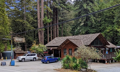
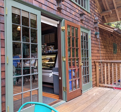
From La Honda, we turned left on Pescadero Creek Road and Haskins Hill. This 2 mile climb is completely shaded, and it was a comfortable 73 degrees. This is about the fifth time this year that I've ridden this road, and repetition makes the somewhat technical screaming descent on the back side easier. Still, it's a challenge to keep up with Dave, but I'm getting closer! We passed by San Mateo County Memorial Park on the outskirts of the town of Loma Mar and a few miles later, we stopped for lunch at the Loma Mar store. I've been here a few times this year (Dave is here almost every week)! In the photo, that's Dave on the patio grabbing a table (not a problem on a Thursday). This is a must visit for anyone traveling through the area. It was completely rebuilt some years back and is a really nice spot for lunch in the redwoods, with tables inside and out. The duck tacos are really good, though a breakfast croissant is a better choice while cycling. (The chicken pot pie is supposed to be dynamite, but it takes too long for a quick bike lunch.)
|
|
Starting in Los Altos
|
|
|
Historic Woodside Store
|
|
|
|
Loma Mar Store and Bistro
|
|
|
A peek inside
|
|
|
|
|
On training rides, we'd turn around here and head back the way we came. Today, we have about 60 miles to go. We continued to Pescadero where we stopped briefly at the Arcangeli bakery so Dave could get some dessert calories. Last year, we turned south towards Santa Cruz. This year, we're heading north on Stage Road. Stage goes from Pescadero to Highway 1 just north of San Gregorio. It's a series of 3 climbs over a total of 7 miles, each climb about 1 mile. I was still a little conservative, saving some energy for the Tunitas climb. We took a short photo break at San Gregorio with a little fog just off the coast in the background. Then we climbed the last and steepest of the trio of climbs to get onto Highway 1. There's a short, very fast descent to the base of Tunitas Creek.
Tunitas Creek and Beyond
Tunitas starts out flat to rolling. The Bike Hut has reopened after a Covid hiatus, but as we were both pretty full on water, we just took a quick photo break. Tunitas is over 9 miles long, but the real climbing starts about 2 miles in. Seven miles, about 1700 feet. There are some solid steep sections on Tunitas, lots of 10% grades in the middle. The temperature was in the mid 60s, helped by the shade cast by tall redwoods. And yet, sweat was pouring into my eyes, so much so that I needed to put the sunglasses in my pocket. I was working really hard, and I was getting tired. Dave could certainly have done this climb quite a bit faster, but we climbed together the whole way. I think he was breathing hard once or twice! The last 2 miles of the climb are more shallow, a bit of a breather. We topped Tunitas at about 66 miles completed, which made it my longest ride of the year. And still 35 miles to go (!) Weren't we just here? As you can see from the map, Kings Mountain and Tunitas are right across from each other on Skyline. This time, we're heading north.
|
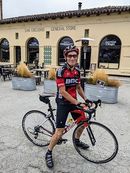
|
| San Gregorio
|
|
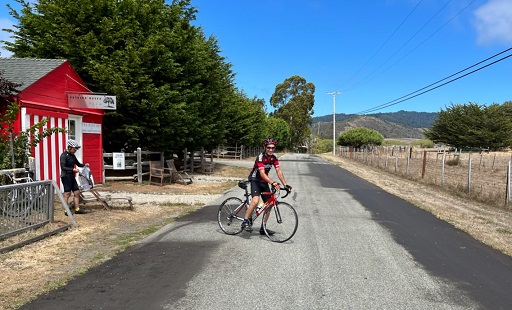
|
| Tunitas Creek Road at the Bike Hut
|
|
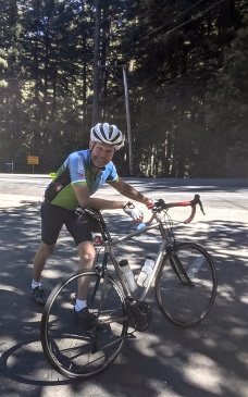
|
| Dave at the top of Tunitas
|
|
|
After a tough climb like Tunitas, it's only fair to have a great descent, and northbound Skyline Blvd fits the bill. It takes a few miles of rolling hills to get to the descent, but once there, it's all downhill and non-technical for about 7 miles. The last mile and a half before the intersection of Highway 92 is often windy - as well as windy  - and there was plenty of wind today, generally cross from the left or a headwind. Nothing like a few good gusts to challenge your bike handling skills. Highway 92 down to Crystal Springs reservoir is a major thoroughfare with only a partial bike lane, but we're going just about as fast as the traffic, so it's never been an issue. I had planned to ride around Crystal Springs towards Polhemus Road as I did in the 2020 ride. But we had been taking our time and we were getting towards rush hour... so we decided to delete that loop. Instead we went directly to Canada road, which involves a short little kick of a 6% climb. After descending for 7 miles, that really stings. - and there was plenty of wind today, generally cross from the left or a headwind. Nothing like a few good gusts to challenge your bike handling skills. Highway 92 down to Crystal Springs reservoir is a major thoroughfare with only a partial bike lane, but we're going just about as fast as the traffic, so it's never been an issue. I had planned to ride around Crystal Springs towards Polhemus Road as I did in the 2020 ride. But we had been taking our time and we were getting towards rush hour... so we decided to delete that loop. Instead we went directly to Canada road, which involves a short little kick of a 6% climb. After descending for 7 miles, that really stings.
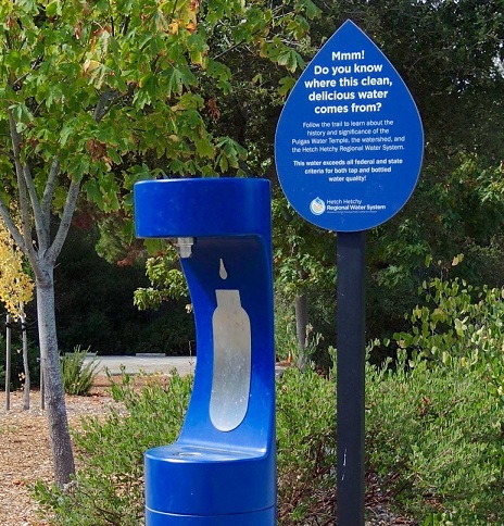
Now let's look at a new chart from the Garmin: temperature. You can see the first 74 miles is in the 60s and 70s. Then, as soon as we hit the valley floor near Crystal Springs, away from the coast and the shade, the temperature starts its own climb, peaking at around 90. Not really unexpected, but the visual is neat. A good water stop is right here, the Pulgas Water Temple, terminus of the Hetch-Hetchy pipeline which feeds Crystal Springs.
|
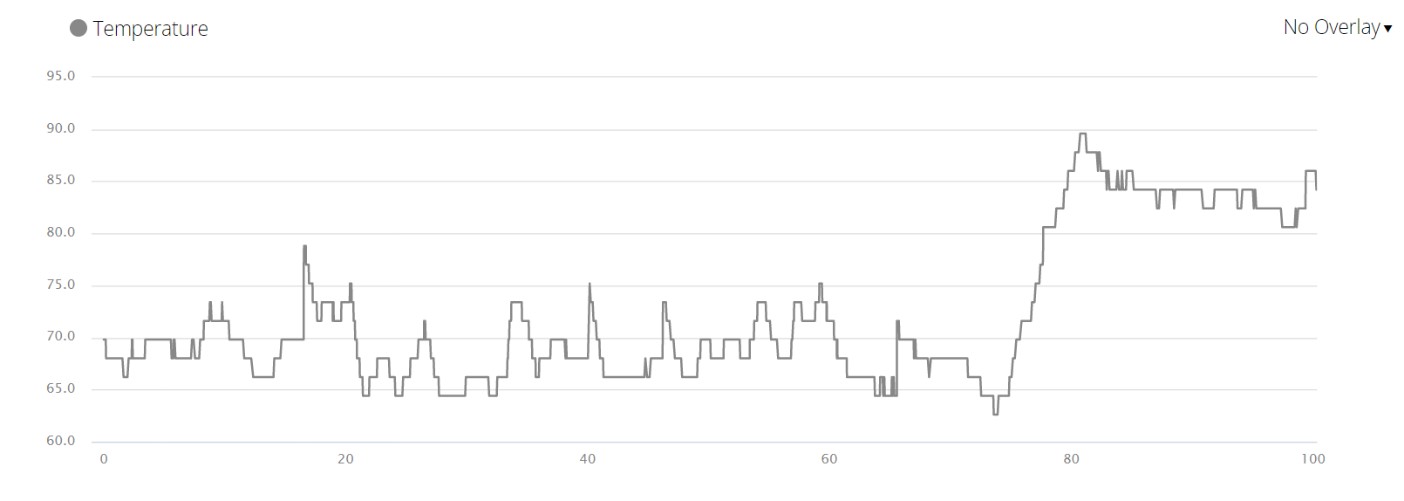
|
Temperature profile
|
|
|
Pulgas Water Fountain
|
|
|
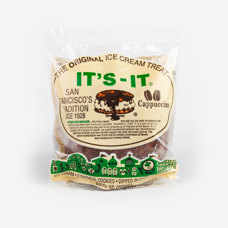
It's it!
|
|
|
|
Dave suggested we pick up the pace along Canada, and I could draft him. Drafting is great for the followers; you use a lot less energy than the leader. But it only works when you can hold the wheel of the guy in front! Dave is a very patient rider. Super strong in all disciplines. And he adjusted his pace accordingly. He asked me if I knew what It's It is. "You mean the ice cream?" Yep! If we rode hard into Woodside, Roberts Market sells them, and he was buying! So after a pretty zippy run into Roberts, we indeed had It's It ice cream sandwiches. I had cappuccino; Dave had mint. I checked later: 340 calories. That was also good after 85 miles.
We rode together on the outskirts of Stanford University and up Arastradero Road where we would split to our respective finish lines. Since we cut a few miles off near Crystal Springs, I knew I'd be short of 100 miles. I told Dave it didn't really matter but if I was over 95 when I got in the vicinity of the finish, I'd do a bonus loop to get to 100. When I got to Los Altos, 96.25! So I did enough to make it 100.3  I climbed 8600 feet, not bad. Dave put in 90.4 miles and 8000 feet. I had plenty to eat and drink - 1700 calories and nearly a gallon of water. We had good weather. Great company (thanks Dave!). It was a really good day for my 32nd Pan Mass Challenge. I climbed 8600 feet, not bad. Dave put in 90.4 miles and 8000 feet. I had plenty to eat and drink - 1700 calories and nearly a gallon of water. We had good weather. Great company (thanks Dave!). It was a really good day for my 32nd Pan Mass Challenge.
|
Post Ride
At this writing, I've raised $11700 with the help of my fantastic sponsors, about 75% of the way towards my $15000 goal. The PMC is over 80% of the way towards its $66M goal. The ride is a challenge, yes. But in the last year, many friends have had the real challenge dealing with half a dozen different forms of cancer. I am very thankful that all are doing well. I hope someday that all forms of cancer are well understood, easily detected, and easily treated. Until then, as the PMC says, there's a lot riding on us.
|
Thank you so much for your support!
|
|
Return to my PMC home page
|

 - and there was plenty of wind today, generally cross from the left or a headwind. Nothing like a few good gusts to challenge your bike handling skills. Highway 92 down to Crystal Springs reservoir is a major thoroughfare with only a partial bike lane, but we're going just about as fast as the traffic, so it's never been an issue. I had planned to ride around Crystal Springs towards Polhemus Road as I did in the 2020 ride. But we had been taking our time and we were getting towards rush hour... so we decided to delete that loop. Instead we went directly to Canada road, which involves a short little kick of a 6% climb. After descending for 7 miles, that really stings.
 I climbed 8600 feet, not bad. Dave put in 90.4 miles and 8000 feet. I had plenty to eat and drink - 1700 calories and nearly a gallon of water. We had good weather. Great company (thanks Dave!). It was a really good day for my 32nd Pan Mass Challenge.


