|
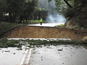
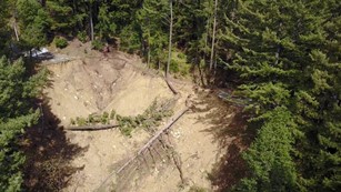
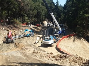
2017 was a challenging year for riding. Winter brought 100 inches of rain; many roads were compromised, some destroyed. Last year, I started the ride by going north on Skyline Blvd. to Castle Rock State Park. Not possible this year! Here's what Skyline looked like, 1/2 mile south of Castle Rock, on February 10, after a complete collapse of a 200 foot section of the road and shoulders. The entire slide is about 1000 feet from top to bottom. The aerial shot is from days later after the powerlines were restrung. And the construction shot is from a few days ago.
|
|
|
|
Construction started in May, and there is progress as you can see, but there's still months to go before we have our main road back. This section of road was common to most of my rides from home. Without it, well... loop rides were not easy, unless you like trail riding on a road bike. So I changed my training: I would do a long ride mid-week from the valley, with shorter/steeper rides on the weekends (laps around Lexington Reservoir, or climbing Black Road which is 12% and very strenuous). On top of that, it's been a hot summer. All of this conspired to create a very low mileage year: just over 1400 by ride day. In 2014, when we crossed Yosemite, I had ridden 2400 miles prior to ride day. My longest ride this year was only 61 miles, about 10 days before the ride.
I may be low on miles, but I am motivated, as is my riding partner Steve. After more than 30 years cancer-free, my mom has been in chemo for several months. That is working well, and we've very glad for that. My aunt, a dear family friend, and Steve's cousin are all battling cancer. We also lost a friend this year to lung cancer. So I planned for my PMC to be a solid 100+ miles this year, albeit with a little less climbing to compensate for the lower base mileage.
As usual, most pictures can be enlarged by clicking on them. (And there's a few more pictures in a Google photo album by following that link. Even a short video!)
|
|
|
Station to Station
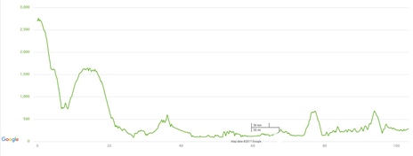
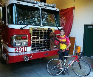
I started at my fire station, as usual. Here I am at 8 AM, with our mascot Decker, sitting on the bumper of our 1+ year old fire engine. The basic ride idea was Steve's: we'd ride to Big Sur. The map and profile are shown above. Seems simple. 103.5 miles, 5400 feet of elevation gain. I was unsure I had the legs for a 42 mile boost on my longest ride. We'll see.
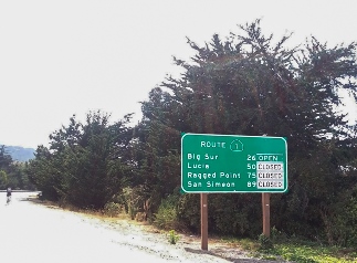
This winter, there were three really spectacular road failures here in Northern Californa: ours, the Pfeiffer Canyon Bridge in north Big Sur, and the Mud Creek slide in south Big Sur. So it seemed fitting to ride basically from one road closed sign to another. Where's Steve? He's got even fewer miles in than I have and decided to do just the 2nd part of the ride. So I'll be solo for the first 58 miles.
Starting from the fire station, I headed right on Skyline (the only choice!), and descended Black Road to get down to Lexington Reservoir. Black is not a fun descent, as it's very steep and narrow. Only at the bottom does it straighten enough to coast for a minute at 40mph! Crossing highway 17, I started the longest climb of the day - Old Santa Cruz Highway. I've descended this many times on rides, including a few west-coast PMCs, but rarely climbed it. This climbs about 1000' over 6 miles through a redwood forest. It's never particularly steep; the average grade is around 3.5%, with only a few 7% sections. And as long as beach traffic doesn't entice people to look for alternate routes, it's very quiet - as it was on ride day. Just a handful of cars. A solid climb to start the day. Turning left onto Summit Road, the next segment is very familiar. Summit rolls for about 3 miles, until the first of the day's good descents, one of my favorites: San Jose Soquel Road (only recently re-opened due to winter damage). This is about 10 miles, almost all downhill, from 1600' to almost sea level. Once again, it was quiet, and only a few cars passed.
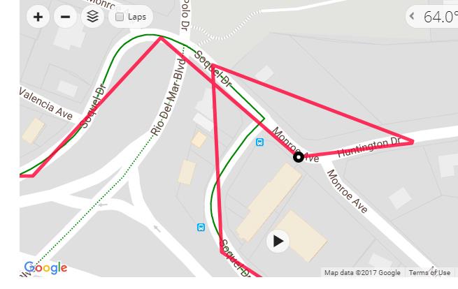
I got into Soquel around 9:40am, right on schedule, and headed south for Corralitos. My typical path into Corralitos is closed - yep, another broken road - so I used a different route. This might be a good spot to talk a little tech. I picked up a new bike computer recently, a Garmin Edge 520. I really like it. I tried to use a feature where I plot the entire ride, load it into the unit, and follow a "course". I was pretty sure I did that. Apparently not. In this segment, there were a few unfamiliar turns, and ... in retrospect, it's kinda funny what it looks like on the map which the Garmin draws as you ride. But at the time, I had to take a short break to determine that I was not following a route. So, plan B: get my phone to give me directions. I wanted to conserve the battery, so I just tried to remember 3 turns ahead, which was enough. Hames Road was the next climb. It's not long, only about a mile, but it has a short segment at 12%. A good burn just before my first stop at the Corralitos fire station. I got some water, some power food, and started towards Castroville.
|
|
Decker, the mascot
|
|
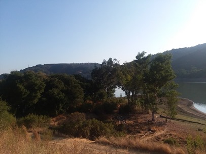
Lexington Reservoir
|
|
| Oops! Missed the turn
|
|
|
Corralitos to Castroville Via Elkhorn Slough
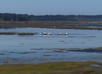
This segment was completely new to me from a cycling perspective. I've spent some time in the Watsonville area for fire training, but the world looks different from a bike. My "plan B" for looking at the phone, getting a few turns, forgetting one, stopping again... was getting old, so ... with plenty of charge in the battery, I just let the phone direct me. Most of the time, this worked well - as long as I could hear it. Getting thru Watsonville was not too bad - thankfully this was a Sunday morning with light traffic. Some of the road shoulders just past Watsonville were pretty narrow, full of sand... thankfully it was a short segment, only a few miles before the turn off to Elkhorn Road. This road goes through the Elkhorn Slough, a 7-mile-long tidal slough and estuary leading to Monterey Bay. This is a very quiet road, rolling up and down. It has a similar profile to laps around Lexington, so I guess that turned out to be good training. Sometimes, the air was sweet with the smell of strawberries from the many fields flanking this area. A hawk was serenading me as I rode through. I found a stranded cyclist here needing help fixing a flat, so I made a short stop, then continued on my way.
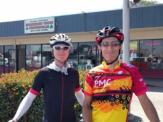
Getting close to the lunch stop, I was happy to have Google maps passing me directions. The next main road is Castroville Blvd, and there's a bike path along side, but on the opposite side; I don't think I would have found the entrance without the GPS. Eventually, this connects to Highway 156. Another example of a sketchy shoulder, and a really busy road. As before, it was a short distance, maybe a mile, on this 4 lane highway, before bicycles are forced to exit - and I was happy to do so, and I'm sure the cars were happy to see me go. I pulled into the lunch stop at Deliciosos Tacos, a very unassuming restaurant with great Mexican food. Steve and his wife Jane were already here. We grabbed lunch - something I forgot to do during last year's PMC ride, a mistake I was not going to repeat. We tanked up with water, and left the artichoke captial of the world.
|
|
Elkhorn Slough
|
|
All important lunch
|
|
|
"I'm Very Confused"
Out of Castroville, there's a significant bike path system which goes all the way to Monterey. It was flat to start, which was nice to get the legs warmed back up after the long-ish lunch stop. As I passed the longest-year-to-date mileage, I was definitely feeling the morning climbs. We followed the path for some time, running into an organized ride on a similar course. The basic idea of this path is to avoid Highway 1, which is a freeway through Monterey. The path passes through Marina, and rolls through the Fort Ord Sand Dunes state park. This section is somewhat reminsicent of riding through the dunes on the outskirts of Provincetown on the 2nd day of many past PMCs. When we got into Monterey, the path went right towards the bay, which seemed opposite to where we wanted to go, so we went straight. We followed Google's directions, ending up by the pier which is pretty, but crowded on a Sunday. We pulled over to consult the GPS. Two things. First, it seemed to think it was night. Second (and Steve will attest to this) it actually said "I'm very confused". This is not something you want to hear from your GPS! Funny and a little frustrating, it seemed like a good time to reboot the phone. It came back up in day mode, and seemed able to plot us a course through Monterey.
Climbing back up towards Highway 1 is about 600' of elevation gained over 2.5 miles. The last part on Viejo Road is the steepest at about 9%. Steve noticed a bike path ahead of us, just before a switchback where the climb continued - I did not recall it from the route plan, but it seemed to run right along Highway 1, connecting Viejo road to next exit. This was a nice shortcut, deleting a bit of climbing of Viejo Road, at a time when I was pegged and really needed a break. Good call, Steve! With 77 miles in, I was really starting to wonder if I could make 100+. We got onto Highway 1, which has a reasonable shoulder, for the second "screamer" descent of the day down to Rio Road in Carmel for the last water stop of the day.
|
|
| Onward to Big Sur
|
|
|
| That's a view
|
|
|
Carmel-By-The-Sea to Big Sur
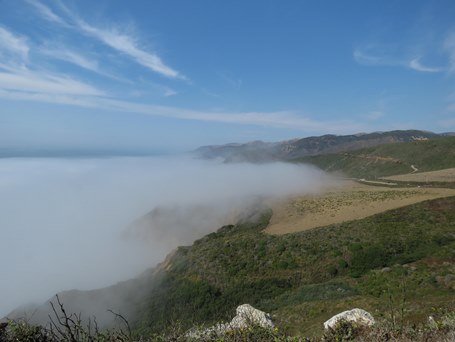
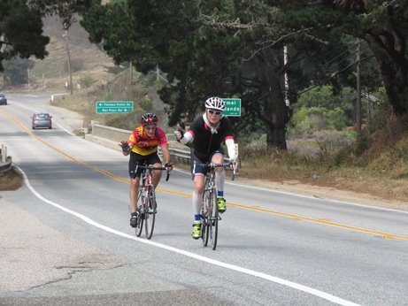
As you can see, the road only goes 26 miles further (maybe a bit less) before the Pfeiffer Canyon bridge is out. This segment is one of the most picturesque anywhere. The coast around Big Sur is rugged, steep, and spooky in the fog. The weather was nice. Occasional fog across the road, but it continued to clear through the afternoon. Highway 1 is many things, but it is certainly not flat. It has several short climbs, and a few longer ones of 1 or 2 miles, many in the 6% range. This is tough on tired legs. Still, Steve and I stayed together much of the time, with occasional splits for different recovery rates. This year, Steve's rally song for tough climbs was "It's a Long Way to Tipperary"
We found some new pavement, some incredible descents, helpful drivers, and we had Beth tracking us for some great photos.
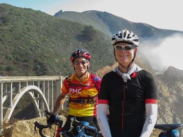
We stopped at the famous Bixby Creek Bridge to pose for some of these pictures, with about 10 miles to go.
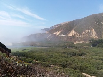
There's a climb right after the bridge, followed by an exhilirating descent shown in the photo below, taken from the next climb.
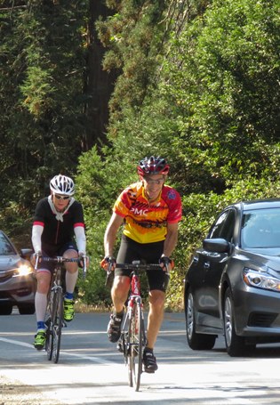
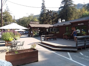
With the finish in sight, we picked up the pace (in the flatter parts, anyway). I mentioned to Steve at least once that it might be cool, but I'm sweatin'! I was making sure to keep hydrated, and fed, and I think this really helped with the last segment this year. Over the last 23 miles, we averaged about 18mph, taking just about 90 minutes to complete this segment. But I could tell this was the absolute limit of what I could do today. In the very last descent, I could see we were descending, but at a climbing pace. We were done, literally. We finished the ride at the Big Sur River Inn; it's only another 3 miles until the road is closed, and reportedly there's not much to see. The bridge should be open in a month or so, reconnecting the two halves of the Big Sur community. We know what it's like to have a community split.
|
|
Mal Paso, about 20 miles to go
|
|
Feeling fine at the Bixby Creek Bridge
|
|
|
|
| A really nice descent
|
|
|
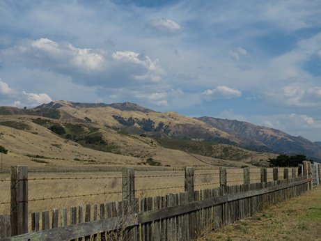
| Scene coming into Big Sur
|
|
|
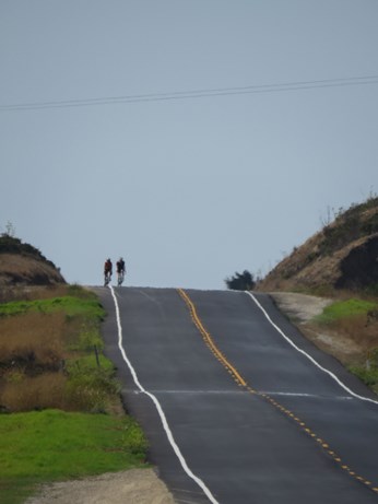
| Cresting a hill with 2 miles to go
|
|
|
|
| A final sprint
|
|
|
| Done, at the Big Sur River Inn
|
|
|
Post ride
Beth drove us back to Rio Road in Carmel, where we met Jane for dinner at The Sea Harvest. We reviewed the ride and agreed that it was a really good day! Good weather, only one or two hot spots; a little fog, but no rain or wet roads. A good course with some challenging climbs, a few rough spots, and some incredible scenery. Great company, great support. I made sure to hydrate, and eat, and that really made a big difference. At 103.5 miles, this was the longest ride I've done in a long time. It felt good to get a boost from the Big Sur scenery, and from Steve's singing, and have some strength left for the last few climbs.
This link will take you to a photo album which has these pictures and more that I could not possibly format into the story.
At this writing, I've raised about $8900, heading for $10000. We keep riding because we still need to. The PMC continues to grow and extend its fundraising because it has to. I hope there comes a day when we do these rides just to ride.
For myself and Steve, and for the 10000+ riders and volunteers for the PMC,
thanks for your support!
|

